North Sterling Reservoir Topo Map Colorado
To zoom in, hover over the map of North Sterling Reservoir
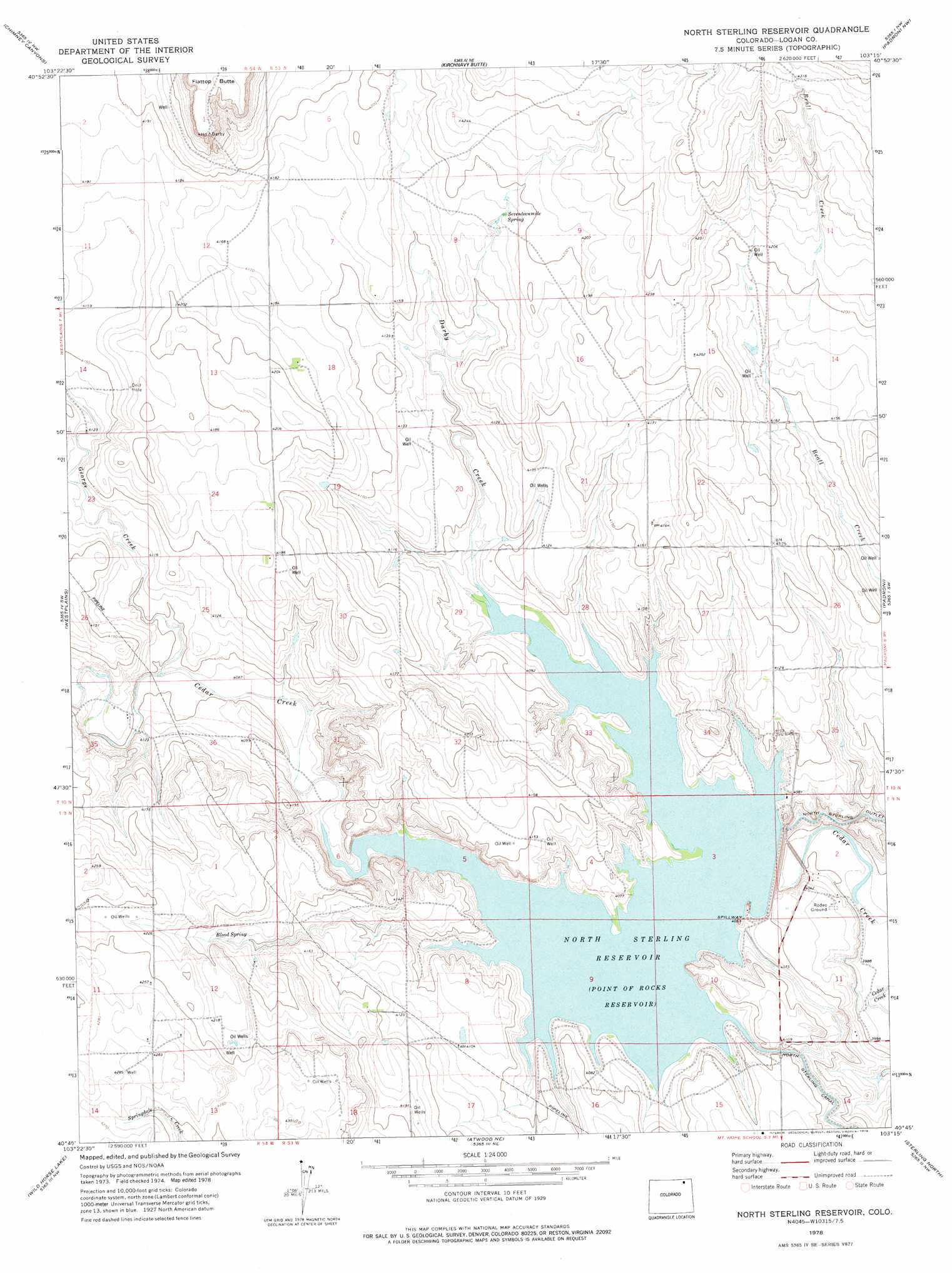
USGS Topo Quad 40103g3 - 1:24,000 scale
| Topo Map Name: | North Sterling Reservoir |
| USGS Topo Quad ID: | 40103g3 |
| Print Size: | ca. 21 1/4" wide x 27" high |
| Southeast Coordinates: | 40.75° N latitude / 103.25° W longitude |
| Map Center Coordinates: | 40.8125° N latitude / 103.3125° W longitude |
| U.S. State: | CO |
| Filename: | o40103g3.jpg |
| Download Map JPG Image: | North Sterling Reservoir topo map 1:24,000 scale |
| Map Type: | Topographic |
| Topo Series: | 7.5´ |
| Map Scale: | 1:24,000 |
| Source of Map Images: | United States Geological Survey (USGS) |
| Alternate Map Versions: |
North Sterling Reservoir CO 1978, updated 1978 Download PDF Buy paper map North Sterling Reservoir CO 2010 Download PDF Buy paper map North Sterling Reservoir CO 2013 Download PDF Buy paper map North Sterling Reservoir CO 2016 Download PDF Buy paper map |
1:24,000 Topo Quads surrounding North Sterling Reservoir
Kimball Se |
Potter Sw |
Potter Se |
Easterly Airport |
Lorenzo |
Dipper Spring |
Chimney Canyons |
Kirchnavy Butte |
Padroni Nw |
Peetz |
Avalo Se |
Westplains |
North Sterling Reservoir |
Padroni |
Iliff |
Stoneham Ne |
Wild Horse Lake |
Atwood Ne |
Sterling North |
Galien |
Stoneham Se |
Willard |
Atwood |
Sterling South |
Reiradon Hill |
> Back to 40103e1 at 1:100,000 scale
> Back to 40102a1 at 1:250,000 scale
> Back to U.S. Topo Maps home
North Sterling Reservoir topo map: Gazetteer
North Sterling Reservoir: Dams
North Sterling Dam elevation 1241m 4071′North Sterling Reservoir: Reservoirs
North Sterling Reservoir elevation 1241m 4071′North Sterling Reservoir: Springs
Blood Spring elevation 1272m 4173′Seventeenmile Spring elevation 1275m 4183′
North Sterling Reservoir: Streams
Darby Creek elevation 1241m 4071′George Creek elevation 1246m 4087′
North Sterling Reservoir: Summits
Flat Top Butte elevation 1329m 4360′North Sterling Reservoir digital topo map on disk
Buy this North Sterling Reservoir topo map showing relief, roads, GPS coordinates and other geographical features, as a high-resolution digital map file on DVD: