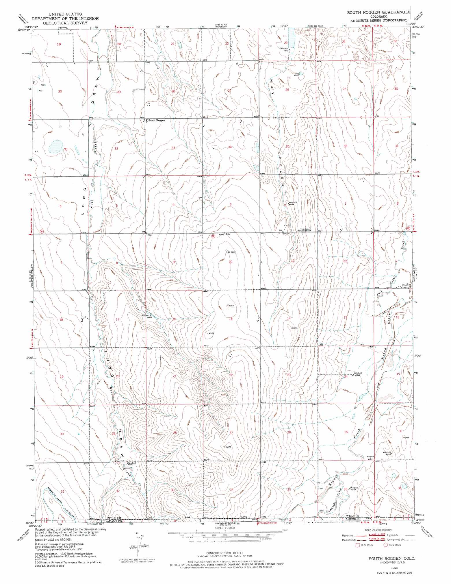
South Roggen Topo Map Colorado
To zoom in, hover over the map of South Roggen
USGS Topo Quad 40104a3 - 1:24,000 scale
| Topo Map Name: | South Roggen |
| USGS Topo Quad ID: | 40104a3 |
| Print Size: | ca. 21 1/4" wide x 27" high |
| Southeast Coordinates: | 40° N latitude / 104.25° W longitude |
| Map Center Coordinates: | 40.0625° N latitude / 104.3125° W longitude |
| U.S. State: | CO |
| Filename: | o40104a3.jpg |
| Download Map JPG Image: | South Roggen topo map 1:24,000 scale |
| Map Type: | Topographic |
| Topo Series: | 7.5´ |
| Map Scale: | 1:24,000 |
| Source of Map Images: | United States Geological Survey (USGS) |
| Alternate Map Versions: |
South Roggen CO 1950, updated 1952 Download PDF Buy paper map South Roggen CO 1950, updated 1952 Download PDF Buy paper map South Roggen CO 1950, updated 1975 Download PDF Buy paper map South Roggen CO 2010 Download PDF Buy paper map South Roggen CO 2013 Download PDF Buy paper map South Roggen CO 2016 Download PDF Buy paper map |
1:24,000 Topo Quads surrounding South Roggen
Valley View School |
Hardin |
Dearfield |
Masters |
Orchard |
Klug Ranch |
Tampa |
Roggen |
Omar |
Wiggins |
Keenesburg |
Prospect Valley |
South Roggen |
Wiggins Sw |
Hoyt |
Horse Creek |
Sunnydale |
Living Springs |
Leader Nw |
Leader |
Manila |
Bennett |
Roper School |
Leader Sw |
Leader Se |
> Back to 40104a1 at 1:100,000 scale
> Back to 40104a1 at 1:250,000 scale
> Back to U.S. Topo Maps home
South Roggen topo map: Gazetteer
South Roggen: Airports
Reid Ranches Airport elevation 1468m 4816′South Roggen: Oilfields
Ranchero Oil Field elevation 1486m 4875′South Roggen: Populated Places
South Roggen elevation 1465m 4806′South Roggen: Streams
Comanche Creek elevation 1485m 4872′South Roggen: Valleys
Hay Gulch elevation 1468m 4816′South Roggen digital topo map on disk
Buy this South Roggen topo map showing relief, roads, GPS coordinates and other geographical features, as a high-resolution digital map file on DVD: