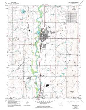
Fort Lupton Topo Map Colorado
To zoom in, hover over the map of Fort Lupton
USGS Topo Quad 40104a7 - 1:24,000 scale
| Topo Map Name: | Fort Lupton |
| USGS Topo Quad ID: | 40104a7 |
| Print Size: | ca. 21 1/4" wide x 27" high |
| Southeast Coordinates: | 40° N latitude / 104.75° W longitude |
| Map Center Coordinates: | 40.0625° N latitude / 104.8125° W longitude |
| U.S. State: | CO |
| Filename: | o40104a7.jpg |
| Download Map JPG Image: | Fort Lupton topo map 1:24,000 scale |
| Map Type: | Topographic |
| Topo Series: | 7.5´ |
| Map Scale: | 1:24,000 |
| Source of Map Images: | United States Geological Survey (USGS) |
| Alternate Map Versions: |
Fort Lupton CO 1949, updated 1964 Download PDF Buy paper map Fort Lupton CO 1949, updated 1966 Download PDF Buy paper map Fort Lupton CO 1949, updated 1970 Download PDF Buy paper map Fort Lupton CO 1949, updated 1970 Download PDF Buy paper map Fort Lupton CO 1949, updated 1980 Download PDF Buy paper map Fort Lupton CO 1949, updated 1994 Download PDF Buy paper map Fort Lupton CO 1950 Download PDF Buy paper map Fort Lupton CO 2010 Download PDF Buy paper map Fort Lupton CO 2013 Download PDF Buy paper map Fort Lupton CO 2016 Download PDF Buy paper map |
1:24,000 Topo Quads surrounding Fort Lupton
> Back to 40104a1 at 1:100,000 scale
> Back to 40104a1 at 1:250,000 scale
> Back to U.S. Topo Maps home
Fort Lupton topo map: Gazetteer
Fort Lupton: Airports
Delventhal Farm Airport elevation 1532m 5026′Fort Lupton: Canals
Brantner Ditch elevation 1524m 5000′Brighton Ditch elevation 1510m 4954′
Brighton Lateral Ditch elevation 1534m 5032′
Fulton Lateral Ditch elevation 1513m 4963′
Lupton Bottoms Ditch elevation 1501m 4924′
Fort Lupton: Dams
Coal Ridge Waste Dam elevation 1502m 4927′H A Smith Dam elevation 1524m 5000′
Munger Number 1 Dam elevation 1541m 5055′
Munger Number 2 Dam elevation 1540m 5052′
Fort Lupton: Mines
Alpha Mine elevation 1493m 4898′Fort Lupton: Populated Places
Aristocrat Ranchettes elevation 1525m 5003′Fort Lupton elevation 1496m 4908′
Powars elevation 1507m 4944′
Wattenberg elevation 1505m 4937′
Fort Lupton: Reservoirs
Coal Ridge Waste Reservoir elevation 1502m 4927′H A Smith Reservoir elevation 1524m 5000′
Munger Reservoir Number 1 elevation 1541m 5055′
Munger Reservoir Number 2 elevation 1540m 5052′
Fort Lupton: Streams
Big Dry Creek elevation 1492m 4895′Little Dry Creek elevation 1490m 4888′
Fort Lupton: Summits
Smith Mound elevation 1583m 5193′Fort Lupton digital topo map on disk
Buy this Fort Lupton topo map showing relief, roads, GPS coordinates and other geographical features, as a high-resolution digital map file on DVD:


