Tampa Topo Map Colorado
To zoom in, hover over the map of Tampa
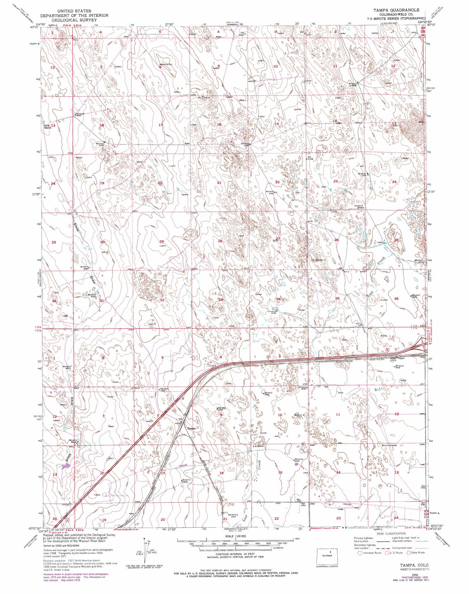
USGS Topo Quad 40104b4 - 1:24,000 scale
| Topo Map Name: | Tampa |
| USGS Topo Quad ID: | 40104b4 |
| Print Size: | ca. 21 1/4" wide x 27" high |
| Southeast Coordinates: | 40.125° N latitude / 104.375° W longitude |
| Map Center Coordinates: | 40.1875° N latitude / 104.4375° W longitude |
| U.S. State: | CO |
| Filename: | o40104b4.jpg |
| Download Map JPG Image: | Tampa topo map 1:24,000 scale |
| Map Type: | Topographic |
| Topo Series: | 7.5´ |
| Map Scale: | 1:24,000 |
| Source of Map Images: | United States Geological Survey (USGS) |
| Alternate Map Versions: |
Tampa CO 1950, updated 1952 Download PDF Buy paper map Tampa CO 1950, updated 1972 Download PDF Buy paper map Tampa CO 1950, updated 1979 Download PDF Buy paper map Tampa CO 2010 Download PDF Buy paper map Tampa CO 2013 Download PDF Buy paper map Tampa CO 2016 Download PDF Buy paper map |
1:24,000 Topo Quads surrounding Tampa
Greeley |
Kersey |
Barnesville |
Point Of Rocks |
Greasewood Lake |
La Salle |
Valley View School |
Hardin |
Dearfield |
Masters |
Milton Reservoir |
Klug Ranch |
Tampa |
Roggen |
Omar |
Hudson |
Keenesburg |
Prospect Valley |
South Roggen |
Wiggins Sw |
Mile High Lakes |
Horse Creek |
Sunnydale |
Living Springs |
Leader Nw |
> Back to 40104a1 at 1:100,000 scale
> Back to 40104a1 at 1:250,000 scale
> Back to U.S. Topo Maps home
Tampa topo map: Gazetteer
Tampa: Mines
Keenesburg Strip Mine elevation 1460m 4790′Tampa: Populated Places
Tampa elevation 1467m 4812′Tampa: Valleys
Ennis Draw elevation 1452m 4763′Tampa digital topo map on disk
Buy this Tampa topo map showing relief, roads, GPS coordinates and other geographical features, as a high-resolution digital map file on DVD: