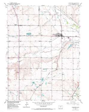
Johnstown Topo Map Colorado
To zoom in, hover over the map of Johnstown
USGS Topo Quad 40104c8 - 1:24,000 scale
| Topo Map Name: | Johnstown |
| USGS Topo Quad ID: | 40104c8 |
| Print Size: | ca. 21 1/4" wide x 27" high |
| Southeast Coordinates: | 40.25° N latitude / 104.875° W longitude |
| Map Center Coordinates: | 40.3125° N latitude / 104.9375° W longitude |
| U.S. State: | CO |
| Filename: | o40104c8.jpg |
| Download Map JPG Image: | Johnstown topo map 1:24,000 scale |
| Map Type: | Topographic |
| Topo Series: | 7.5´ |
| Map Scale: | 1:24,000 |
| Source of Map Images: | United States Geological Survey (USGS) |
| Alternate Map Versions: |
Johnstown CO 1950, updated 1960 Download PDF Buy paper map Johnstown CO 1950, updated 1970 Download PDF Buy paper map Johnstown CO 1950, updated 1970 Download PDF Buy paper map Johnstown CO 1950, updated 1970 Download PDF Buy paper map Johnstown CO 1951 Download PDF Buy paper map Johnstown CO 1951 Download PDF Buy paper map Johnstown CO 2010 Download PDF Buy paper map Johnstown CO 2013 Download PDF Buy paper map Johnstown CO 2016 Download PDF Buy paper map |
1:24,000 Topo Quads surrounding Johnstown
> Back to 40104a1 at 1:100,000 scale
> Back to 40104a1 at 1:250,000 scale
> Back to U.S. Topo Maps home
Johnstown topo map: Gazetteer
Johnstown: Canals
Farmers Extension Canal elevation 1522m 4993′Hill and Brush Ditch elevation 1465m 4806′
Hillsboro Ditch elevation 1475m 4839′
Johnstown: Dams
Akers and Tarr Dam elevation 1534m 5032′Clennon Dam elevation 1505m 4937′
Hartford Dam elevation 1516m 4973′
Isabel Myron Dam elevation 1525m 5003′
Johnstown Dam elevation 1516m 4973′
Little Gem Dam elevation 1519m 4983′
Little Thompson Dam elevation 1470m 4822′
Marshall Number 2 Dam elevation 1490m 4888′
Miantenoma Dam elevation 1488m 4881′
Minnie Dam elevation 1519m 4983′
Moeller Dam elevation 1465m 4806′
Parmalee Dam elevation 1540m 5052′
Johnstown: Lakes
Hill Lake elevation 1524m 5000′Johnstown: Populated Places
Buda elevation 1521m 4990′Bunyan elevation 1499m 4917′
Clark elevation 1474m 4835′
Elwell elevation 1507m 4944′
Hardman elevation 1458m 4783′
Johnstown elevation 1479m 4852′
Kahler elevation 1528m 5013′
Pulliam elevation 1479m 4852′
Walker elevation 1516m 4973′
Wildcat elevation 1455m 4773′
Johnstown: Reservoirs
Akers and Tarr Reservoir elevation 1534m 5032′Ballinger Reservoir elevation 1529m 5016′
Clennon Reservoir elevation 1505m 4937′
Davis Reservoir elevation 1534m 5032′
Hartford Reservoir elevation 1516m 4973′
Hillsboro Reservoir elevation 1467m 4812′
Isabel Myron Reservoir elevation 1525m 5003′
Johnstown Reservoir elevation 1516m 4973′
Little Gem Reservoir elevation 1519m 4983′
Little Thompson Reservoir elevation 1470m 4822′
Marshall Reservoir Number 2 elevation 1490m 4888′
Miantenoma Reservoir elevation 1488m 4881′
Minnie Reservoir elevation 1519m 4983′
Moeller Reservoir elevation 1465m 4806′
Parmalee Reservoir elevation 1540m 5052′
Johnstown digital topo map on disk
Buy this Johnstown topo map showing relief, roads, GPS coordinates and other geographical features, as a high-resolution digital map file on DVD:


