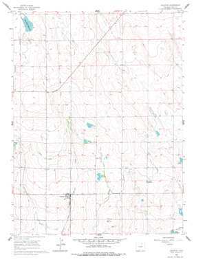
Galeton Topo Map Colorado
To zoom in, hover over the map of Galeton
USGS Topo Quad 40104e5 - 1:24,000 scale
| Topo Map Name: | Galeton |
| USGS Topo Quad ID: | 40104e5 |
| Print Size: | ca. 21 1/4" wide x 27" high |
| Southeast Coordinates: | 40.5° N latitude / 104.5° W longitude |
| Map Center Coordinates: | 40.5625° N latitude / 104.5625° W longitude |
| U.S. State: | CO |
| Filename: | o40104e5.jpg |
| Download Map JPG Image: | Galeton topo map 1:24,000 scale |
| Map Type: | Topographic |
| Topo Series: | 7.5´ |
| Map Scale: | 1:24,000 |
| Source of Map Images: | United States Geological Survey (USGS) |
| Alternate Map Versions: |
Galeton CO 1960, updated 1962 Download PDF Buy paper map Galeton CO 1960, updated 1962 Download PDF Buy paper map Galeton CO 1960, updated 1977 Download PDF Buy paper map Galeton CO 1997, updated 2000 Download PDF Buy paper map Galeton CO 2011 Download PDF Buy paper map Galeton CO 2013 Download PDF Buy paper map Galeton CO 2016 Download PDF Buy paper map |
| FStopo: | US Forest Service topo Galeton is available: Download FStopo PDF Download FStopo TIF |
1:24,000 Topo Quads surrounding Galeton
> Back to 40104e1 at 1:100,000 scale
> Back to 40104a1 at 1:250,000 scale
> Back to U.S. Topo Maps home
Galeton topo map: Gazetteer
Galeton: Dams
John Keller Dam elevation 1494m 4901′Owl Creek Dam elevation 1499m 4917′
Galeton: Populated Places
Galeton elevation 1454m 4770′Galeton: Reservoirs
Allison Reservoir elevation 1472m 4829′Cole Reservoir elevation 1491m 4891′
John Keller Reservoir elevation 1494m 4901′
Mason Reservoir elevation 1474m 4835′
Owl Creek Reservoir elevation 1499m 4917′
Galeton digital topo map on disk
Buy this Galeton topo map showing relief, roads, GPS coordinates and other geographical features, as a high-resolution digital map file on DVD:


