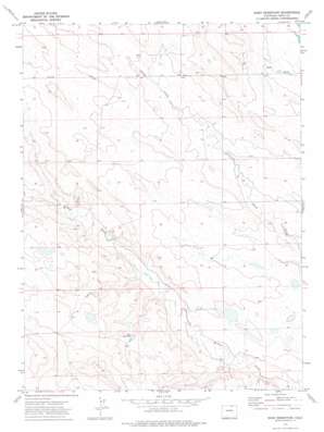
Reno Reservoir Topo Map Colorado
To zoom in, hover over the map of Reno Reservoir
USGS Topo Quad 40104g4 - 1:24,000 scale
| Topo Map Name: | Reno Reservoir |
| USGS Topo Quad ID: | 40104g4 |
| Print Size: | ca. 21 1/4" wide x 27" high |
| Southeast Coordinates: | 40.75° N latitude / 104.375° W longitude |
| Map Center Coordinates: | 40.8125° N latitude / 104.4375° W longitude |
| U.S. State: | CO |
| Filename: | o40104g4.jpg |
| Download Map JPG Image: | Reno Reservoir topo map 1:24,000 scale |
| Map Type: | Topographic |
| Topo Series: | 7.5´ |
| Map Scale: | 1:24,000 |
| Source of Map Images: | United States Geological Survey (USGS) |
| Alternate Map Versions: |
Reno Reservoir CO 1972, updated 1974 Download PDF Buy paper map Reno Reservoir CO 1997, updated 2000 Download PDF Buy paper map Reno Reservoir CO 2011 Download PDF Buy paper map Reno Reservoir CO 2013 Download PDF Buy paper map Reno Reservoir CO 2016 Download PDF Buy paper map |
| FStopo: | US Forest Service topo Reno Reservoir is available: Download FStopo PDF Download FStopo TIF |
1:24,000 Topo Quads surrounding Reno Reservoir
> Back to 40104e1 at 1:100,000 scale
> Back to 40104a1 at 1:250,000 scale
> Back to U.S. Topo Maps home
Reno Reservoir topo map: Gazetteer
Reno Reservoir: Dams
Seven Reverse Y Number 1 Dam elevation 1526m 5006′Reno Reservoir: Reservoirs
Reno Reservoir elevation 1569m 5147′Seven Reverse Y Number 1 Reservoir elevation 1526m 5006′
Reno Reservoir: Springs
Oasis Spring elevation 1570m 5150′Reno Reservoir: Summits
Crow Valley Hill elevation 1635m 5364′Reno Reservoir: Wells
Bear Water Well elevation 1553m 5095′Reno Reservoir digital topo map on disk
Buy this Reno Reservoir topo map showing relief, roads, GPS coordinates and other geographical features, as a high-resolution digital map file on DVD:


