Carr West Topo Map Colorado
To zoom in, hover over the map of Carr West
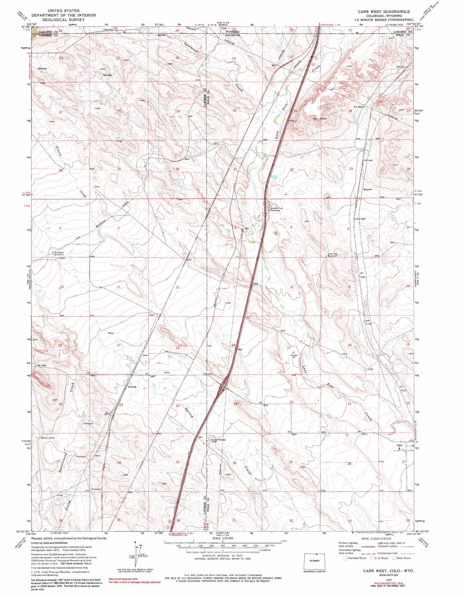
USGS Topo Quad 40104h8 - 1:24,000 scale
| Topo Map Name: | Carr West |
| USGS Topo Quad ID: | 40104h8 |
| Print Size: | ca. 21 1/4" wide x 27" high |
| Southeast Coordinates: | 40.875° N latitude / 104.875° W longitude |
| Map Center Coordinates: | 40.9375° N latitude / 104.9375° W longitude |
| U.S. States: | CO, WY |
| Filename: | o40104h8.jpg |
| Download Map JPG Image: | Carr West topo map 1:24,000 scale |
| Map Type: | Topographic |
| Topo Series: | 7.5´ |
| Map Scale: | 1:24,000 |
| Source of Map Images: | United States Geological Survey (USGS) |
| Alternate Map Versions: |
Carr West CO 1972, updated 1974 Download PDF Buy paper map Carr West CO 1972, updated 1974 Download PDF Buy paper map Carr West CO 2010 Download PDF Buy paper map Carr West CO 2013 Download PDF Buy paper map Carr West CO 2016 Download PDF Buy paper map |
1:24,000 Topo Quads surrounding Carr West
Hecla |
Silver Crown |
Round Top Lake |
Cheyenne North |
Archer |
Granite |
Emkay |
Borie |
Cheyenne South |
Altvan |
Table Mountain |
Round Butte |
Carr West |
Carr East |
Eastman Creek North |
Livermore |
Buckeye |
Carr Sw |
Dover |
Eastman Creek South |
Laporte |
Wellington |
Cobb Lake |
Nunn |
Antelope Reservoir |
> Back to 40104e1 at 1:100,000 scale
> Back to 40104a1 at 1:250,000 scale
> Back to U.S. Topo Maps home
Carr West topo map: Gazetteer
Carr West: Mines
Woodhams Quarry elevation 1878m 6161′Carr West: Populated Places
Norfolk elevation 1798m 5898′Warren elevation 1805m 5921′
Carr West: Streams
Graves Creek elevation 1799m 5902′Lone Tree Creek elevation 1734m 5688′
Spotwood Creek elevation 1825m 5987′
Spotwood Creek elevation 1825m 5987′
Carr West digital topo map on disk
Buy this Carr West topo map showing relief, roads, GPS coordinates and other geographical features, as a high-resolution digital map file on DVD: