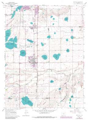
Berthoud Topo Map Colorado
To zoom in, hover over the map of Berthoud
USGS Topo Quad 40105c1 - 1:24,000 scale
| Topo Map Name: | Berthoud |
| USGS Topo Quad ID: | 40105c1 |
| Print Size: | ca. 21 1/4" wide x 27" high |
| Southeast Coordinates: | 40.25° N latitude / 105° W longitude |
| Map Center Coordinates: | 40.3125° N latitude / 105.0625° W longitude |
| U.S. State: | CO |
| Filename: | o40105c1.jpg |
| Download Map JPG Image: | Berthoud topo map 1:24,000 scale |
| Map Type: | Topographic |
| Topo Series: | 7.5´ |
| Map Scale: | 1:24,000 |
| Source of Map Images: | United States Geological Survey (USGS) |
| Alternate Map Versions: |
Berthoud CO 1960, updated 1963 Download PDF Buy paper map Berthoud CO 1960, updated 1963 Download PDF Buy paper map Berthoud CO 1960, updated 1969 Download PDF Buy paper map Berthoud CO 1960, updated 1970 Download PDF Buy paper map Berthoud CO 1960, updated 1970 Download PDF Buy paper map Berthoud CO 1960, updated 1984 Download PDF Buy paper map Berthoud CO 2010 Download PDF Buy paper map Berthoud CO 2013 Download PDF Buy paper map Berthoud CO 2016 Download PDF Buy paper map |
1:24,000 Topo Quads surrounding Berthoud
> Back to 40105a1 at 1:100,000 scale
> Back to 40104a1 at 1:250,000 scale
> Back to U.S. Topo Maps home
Berthoud topo map: Gazetteer
Berthoud: Canals
Big Thompson Ditch Number 2 elevation 1508m 4947′Ide and Starboard Ditch elevation 1541m 5055′
Lake Ditch elevation 1552m 5091′
Mead Lateral elevation 1546m 5072′
New Ish Ditch elevation 1548m 5078′
Old Ish Ditch elevation 1543m 5062′
Rockwell Ditch elevation 1499m 4917′
Supply Ditch elevation 1573m 5160′
Upper Highland Ditch elevation 1567m 5141′
Berthoud: Dams
Bacon Lake Dam elevation 1518m 4980′Baxter Dam elevation 1518m 4980′
Berthoud Dam elevation 1559m 5114′
Chapman Dam elevation 1532m 5026′
De France Dam elevation 1544m 5065′
Handy Dam elevation 1565m 5134′
Hummel Dam elevation 1524m 5000′
Ide and Starbird Number 1 Dam elevation 1545m 5068′
Ide and Starbird Number 2 Dam elevation 1540m 5052′
Ish Number 3 Dam elevation 1555m 5101′
Lone Tree Dam elevation 1565m 5134′
Loveland Dam elevation 1547m 5075′
Rockwell Dam elevation 1510m 4954′
Ryan Gulch Dam elevation 1528m 5013′
Sunny Slope Dam elevation 1541m 5055′
Berthoud: Mines
Berthoud Quarry elevation 1538m 5045′Berthoud: Populated Places
Berthoud elevation 1535m 5036′Berts Corner elevation 1547m 5075′
Campion elevation 1560m 5118′
Welty elevation 1535m 5036′
Berthoud: Reservoirs
Bacon Lake elevation 1518m 4980′Bacon Reservoir elevation 1518m 4980′
Baxter Lake elevation 1518m 4980′
Berthoud Reservoir elevation 1559m 5114′
Chapman Reservoir elevation 1532m 5026′
Coleman Reservoir elevation 1554m 5098′
De France Reservoir elevation 1544m 5065′
DeFrance Reservoir elevation 1544m 5065′
Handy Reservoir elevation 1565m 5134′
Home Supply Reservoir elevation 1565m 5134′
Hummel Reservoir elevation 1524m 5000′
Ide and Starbird Reservoir Number 1 elevation 1545m 5068′
Ide and Starbird Reservoir Number 2 elevation 1540m 5052′
Ish Reservoir elevation 1555m 5101′
Loveland Reservoir elevation 1547m 5075′
Miller Reservoir elevation 1519m 4983′
Newell Lake elevation 1512m 4960′
Rockwell Reservoir elevation 1510m 4954′
Ryan Gulch Lake elevation 1529m 5016′
Ryan Gulch Reservoir elevation 1528m 5013′
Sunny Slope Reservoir elevation 1541m 5055′
Sunnyslope Reservoir elevation 1542m 5059′
Thomas Reservoir elevation 1544m 5065′
Welch Reservoir elevation 1565m 5134′
Berthoud: Streams
Dry Creek elevation 1511m 4957′Berthoud: Summits
Big Owl Hill elevation 1549m 5082′Twin Mounds elevation 1571m 5154′
Berthoud: Valleys
Big Hollow elevation 1490m 4888′Holmes Draw elevation 1500m 4921′
Berthoud digital topo map on disk
Buy this Berthoud topo map showing relief, roads, GPS coordinates and other geographical features, as a high-resolution digital map file on DVD:


