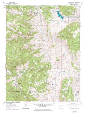
Pinewood Lake Topo Map Colorado
To zoom in, hover over the map of Pinewood Lake
USGS Topo Quad 40105c3 - 1:24,000 scale
| Topo Map Name: | Pinewood Lake |
| USGS Topo Quad ID: | 40105c3 |
| Print Size: | ca. 21 1/4" wide x 27" high |
| Southeast Coordinates: | 40.25° N latitude / 105.25° W longitude |
| Map Center Coordinates: | 40.3125° N latitude / 105.3125° W longitude |
| U.S. State: | CO |
| Filename: | o40105c3.jpg |
| Download Map JPG Image: | Pinewood Lake topo map 1:24,000 scale |
| Map Type: | Topographic |
| Topo Series: | 7.5´ |
| Map Scale: | 1:24,000 |
| Source of Map Images: | United States Geological Survey (USGS) |
| Alternate Map Versions: |
Rattlesnake Reservoir CO 1962, updated 1965 Download PDF Buy paper map Pinewood Lake CO 1962, updated 1971 Download PDF Buy paper map Pinewood Lake CO 1962, updated 1978 Download PDF Buy paper map Pinewood Lake CO 2011 Download PDF Buy paper map Pinewood Lake CO 2013 Download PDF Buy paper map Pinewood Lake CO 2016 Download PDF Buy paper map |
| FStopo: | US Forest Service topo Pinewood Lake is available: Download FStopo PDF Download FStopo TIF |
1:24,000 Topo Quads surrounding Pinewood Lake
> Back to 40105a1 at 1:100,000 scale
> Back to 40104a1 at 1:250,000 scale
> Back to U.S. Topo Maps home
Pinewood Lake topo map: Gazetteer
Pinewood Lake: Canals
Pole Hill Canal elevation 2263m 7424′Pinewood Lake: Dams
Rattlesnake Dam elevation 2124m 6968′South Side Dam elevation 2524m 8280′
Pinewood Lake: Flats
Drummer Flat elevation 2066m 6778′Little Elk Park elevation 2023m 6637′
Pincher Park elevation 2177m 7142′
Rattlesnake Park elevation 2047m 6715′
Pinewood Lake: Lakes
Crescent Lake elevation 1938m 6358′Pinewood Lake: Mines
Cojade Mine elevation 2107m 6912′Colorado Rose Red Quarry elevation 1995m 6545′
Diamond K Quarry elevation 2013m 6604′
Howe Quarry elevation 2013m 6604′
Jacobson and Lyons Quarry elevation 2013m 6604′
Kirts Quarry elevation 2013m 6604′
Ohline Mine elevation 2013m 6604′
Rattlesnake Park Mine elevation 2116m 6942′
Redstone Quarry elevation 2013m 6604′
Pinewood Lake: Pillars
Button Rock elevation 2442m 8011′Pinewood Lake: Populated Places
Noland elevation 1837m 6026′Pinewood Springs elevation 2043m 6702′
Pinewood Lake: Reservoirs
Pinewood Lake elevation 1998m 6555′South Side Reservoir elevation 2524m 8280′
Pinewood Lake: Ridges
Elk Ridge elevation 2574m 8444′Pinewood Lake: Streams
North Fork Little Thompson River elevation 1756m 5761′Pinewood Lake: Summits
Bald Mountain elevation 2162m 7093′Beech Hill elevation 1987m 6519′
Blue Mountain elevation 2406m 7893′
Gray Mountain elevation 1992m 6535′
Indian Mountain elevation 2000m 6561′
Moose Mountain elevation 2456m 8057′
Round Mountain elevation 2270m 7447′
Rowell Hill elevation 2000m 6561′
Pinewood Lake: Tunnels
Bald Mountain Tunnel elevation 2050m 6725′Rattlesnake Tunnel elevation 2119m 6952′
Pinewood Lake: Valleys
Beartrap Gulch elevation 1926m 6318′Burnett Gulch elevation 1863m 6112′
Chickenhouse Gulch elevation 1911m 6269′
Devils Gulch elevation 2142m 7027′
Dry Hollow elevation 1695m 5561′
Emhaw Gulch elevation 2199m 7214′
Hell Canyon elevation 1912m 6272′
Howard Gulch elevation 1793m 5882′
Maure Hollow elevation 1963m 6440′
Mill Gulch elevation 1965m 6446′
Muggins Gulch elevation 2030m 6660′
Rabbit Gulch elevation 2335m 7660′
Rowell Gulch elevation 1717m 5633′
Skinner Gulch elevation 1987m 6519′
Spruce Gulch elevation 1793m 5882′
Pinewood Lake digital topo map on disk
Buy this Pinewood Lake topo map showing relief, roads, GPS coordinates and other geographical features, as a high-resolution digital map file on DVD:


