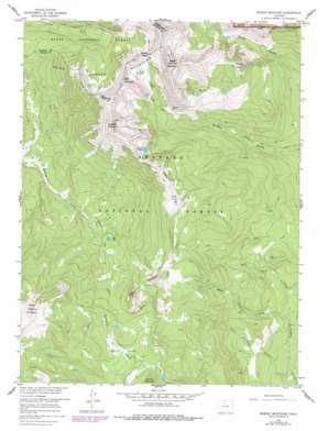
Bowen Mountain Topo Map Colorado
To zoom in, hover over the map of Bowen Mountain
USGS Topo Quad 40105c8 - 1:24,000 scale
| Topo Map Name: | Bowen Mountain |
| USGS Topo Quad ID: | 40105c8 |
| Print Size: | ca. 21 1/4" wide x 27" high |
| Southeast Coordinates: | 40.25° N latitude / 105.875° W longitude |
| Map Center Coordinates: | 40.3125° N latitude / 105.9375° W longitude |
| U.S. State: | CO |
| Filename: | o40105c8.jpg |
| Download Map JPG Image: | Bowen Mountain topo map 1:24,000 scale |
| Map Type: | Topographic |
| Topo Series: | 7.5´ |
| Map Scale: | 1:24,000 |
| Source of Map Images: | United States Geological Survey (USGS) |
| Alternate Map Versions: |
Bowen Mountain CO 1957, updated 1959 Download PDF Buy paper map Bowen Mountain CO 1957, updated 1959 Download PDF Buy paper map Bowen Mountain CO 1957, updated 1960 Download PDF Buy paper map Bowen Mountain CO 1957, updated 1960 Download PDF Buy paper map Bowen Mountain CO 1957, updated 1974 Download PDF Buy paper map Bowen Mountain CO 1957, updated 1978 Download PDF Buy paper map Bowen Mountain CO 1957, updated 1978 Download PDF Buy paper map Bowen Mountain CO 2011 Download PDF Buy paper map Bowen Mountain CO 2013 Download PDF Buy paper map Bowen Mountain CO 2016 Download PDF Buy paper map |
| FStopo: | US Forest Service topo Bowen Mountain is available: Download FStopo PDF Download FStopo TIF |
1:24,000 Topo Quads surrounding Bowen Mountain
> Back to 40105a1 at 1:100,000 scale
> Back to 40104a1 at 1:250,000 scale
> Back to U.S. Topo Maps home
Bowen Mountain topo map: Gazetteer
Bowen Mountain: Flats
Pony Park elevation 3030m 9940′Bowen Mountain: Gaps
Bowen Pass elevation 3497m 11473′Bowen Mountain: Lakes
Blue Lake elevation 3260m 10695′Bowen Lake elevation 3360m 11023′
Lost Lake elevation 2947m 9668′
Ruby Lake elevation 3424m 11233′
Bowen Mountain: Mines
Wolverine Mine elevation 3184m 10446′Bowen Mountain: Ridges
Blue Ridge elevation 3534m 11594′Bowen Mountain: Streams
Middle Supply Creek elevation 2758m 9048′North Supply Creek elevation 2758m 9048′
South Supply Creek elevation 2642m 8667′
Bowen Mountain: Summits
Bowen Mountain elevation 3823m 12542′Cascade Mountain elevation 3746m 12290′
Gravel Mountain elevation 3530m 11581′
Mineral Point elevation 3501m 11486′
Porphyry Peaks elevation 3269m 10725′
Ruby Mountain elevation 3660m 12007′
Bowen Mountain: Trails
Bowen Trail elevation 3037m 9963′Gilsonite Trail elevation 3065m 10055′
Illinois River Trail elevation 3060m 10039′
Mineral Point Trail elevation 3296m 10813′
Supply Creek Trail elevation 2930m 9612′
Wolverine Trail elevation 3419m 11217′
Bowen Mountain digital topo map on disk
Buy this Bowen Mountain topo map showing relief, roads, GPS coordinates and other geographical features, as a high-resolution digital map file on DVD:


