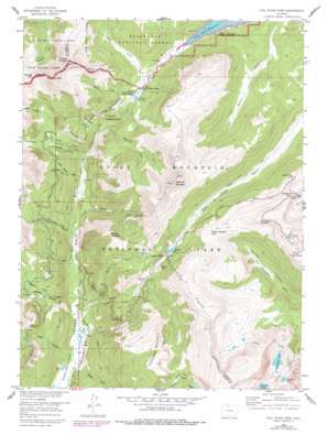
Fall River Pass Topo Map Colorado
To zoom in, hover over the map of Fall River Pass
USGS Topo Quad 40105d7 - 1:24,000 scale
| Topo Map Name: | Fall River Pass |
| USGS Topo Quad ID: | 40105d7 |
| Print Size: | ca. 21 1/4" wide x 27" high |
| Southeast Coordinates: | 40.375° N latitude / 105.75° W longitude |
| Map Center Coordinates: | 40.4375° N latitude / 105.8125° W longitude |
| U.S. State: | CO |
| Filename: | o40105d7.jpg |
| Download Map JPG Image: | Fall River Pass topo map 1:24,000 scale |
| Map Type: | Topographic |
| Topo Series: | 7.5´ |
| Map Scale: | 1:24,000 |
| Source of Map Images: | United States Geological Survey (USGS) |
| Alternate Map Versions: |
Fall River Pass CO 1958, updated 1959 Download PDF Buy paper map Fall River Pass CO 1958, updated 1962 Download PDF Buy paper map Fall River Pass CO 1958, updated 1971 Download PDF Buy paper map Fall River Pass CO 1958, updated 1983 Download PDF Buy paper map Fall River Pass CO 2011 Download PDF Buy paper map Fall River Pass CO 2013 Download PDF Buy paper map Fall River Pass CO 2016 Download PDF Buy paper map |
| FStopo: | US Forest Service topo Fall River Pass is available: Download FStopo PDF Download FStopo TIF |
1:24,000 Topo Quads surrounding Fall River Pass
> Back to 40105a1 at 1:100,000 scale
> Back to 40104a1 at 1:250,000 scale
> Back to U.S. Topo Maps home
Fall River Pass topo map: Gazetteer
Fall River Pass: Canals
Grand Ditch elevation 3117m 10226′Upper Michigan Ditch elevation 3159m 10364′
Fall River Pass: Flats
Hells Hip Pocket elevation 3045m 9990′Shipler Park elevation 2787m 9143′
Fall River Pass: Gaps
Fall River Pass elevation 3585m 11761′Forest Canyon Pass elevation 3448m 11312′
La Poudre Pass elevation 3104m 10183′
Milner Pass elevation 3279m 10757′
Thunder Pass elevation 3454m 11332′
Fall River Pass: Lakes
Arrowhead Lake elevation 3401m 11158′Bighorn Lake elevation 3371m 11059′
Doughnut Lake elevation 3432m 11259′
Iceberg Lake elevation 3615m 11860′
Inkwell Lake elevation 3499m 11479′
Lake Irene elevation 3239m 10626′
Love Lake elevation 3435m 11269′
Poudre Lake elevation 3278m 10754′
Fall River Pass: Ridges
The Crater elevation 3272m 10734′Fall River Pass: Streams
Beaver Creek elevation 2733m 8966′Big Dutch Creek elevation 2791m 9156′
Lady Creek elevation 2927m 9603′
Little Dutch Creek elevation 2849m 9347′
Lost Creek elevation 2775m 9104′
Lulu Creek elevation 2866m 9402′
Middle Dutch Creek elevation 2986m 9796′
Mosquito Creek elevation 3012m 9881′
Neota Creek elevation 3096m 10157′
Opposition Creek elevation 2754m 9035′
Phantom Creek elevation 2742m 8996′
Sawmill Creek elevation 2859m 9379′
Specimen Creek elevation 2965m 9727′
Squeak Creek elevation 2745m 9005′
Timber Creek elevation 2719m 8920′
Fall River Pass: Summits
Jackstraw Mountain elevation 3564m 11692′Lulu Mountain elevation 3719m 12201′
Mount Neota elevation 3561m 11683′
Sheep Rock elevation 3325m 10908′
Shipler Mountain elevation 3443m 11295′
Specimen Mountain elevation 3798m 12460′
Thunder Mountain elevation 3666m 12027′
Fall River Pass: Trails
La Poudre Pass Trail elevation 2847m 9340′Red Mountain Trail elevation 3032m 9947′
Specimen Mountain Trail elevation 3577m 11735′
Thunder Pass Trail elevation 3141m 10305′
Fall River Pass: Valleys
Box Canyon elevation 3195m 10482′Crater Gulch elevation 2804m 9199′
Hitchings Gulch elevation 2795m 9169′
Little Yellowstone elevation 2899m 9511′
Red Gulch elevation 2733m 8966′
Skeleton Gulch elevation 2869m 9412′
Fall River Pass digital topo map on disk
Buy this Fall River Pass topo map showing relief, roads, GPS coordinates and other geographical features, as a high-resolution digital map file on DVD:


