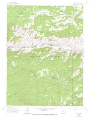
Rustic Topo Map Colorado
To zoom in, hover over the map of Rustic
USGS Topo Quad 40105f5 - 1:24,000 scale
| Topo Map Name: | Rustic |
| USGS Topo Quad ID: | 40105f5 |
| Print Size: | ca. 21 1/4" wide x 27" high |
| Southeast Coordinates: | 40.625° N latitude / 105.5° W longitude |
| Map Center Coordinates: | 40.6875° N latitude / 105.5625° W longitude |
| U.S. State: | CO |
| Filename: | o40105f5.jpg |
| Download Map JPG Image: | Rustic topo map 1:24,000 scale |
| Map Type: | Topographic |
| Topo Series: | 7.5´ |
| Map Scale: | 1:24,000 |
| Source of Map Images: | United States Geological Survey (USGS) |
| Alternate Map Versions: |
Rustic CO 1962, updated 1965 Download PDF Buy paper map Rustic CO 1962, updated 1968 Download PDF Buy paper map Rustic CO 2011 Download PDF Buy paper map Rustic CO 2013 Download PDF Buy paper map Rustic CO 2016 Download PDF Buy paper map |
| FStopo: | US Forest Service topo Rustic is available: Download FStopo PDF Download FStopo TIF |
1:24,000 Topo Quads surrounding Rustic
> Back to 40105e1 at 1:100,000 scale
> Back to 40104a1 at 1:250,000 scale
> Back to U.S. Topo Maps home
Rustic topo map: Gazetteer
Rustic: Dams
Pavel Number 1 Dam elevation 2397m 7864′Pavel Number 3 Dam elevation 2434m 7985′
Pavel Number 5 Dam elevation 2419m 7936′
Rustic: Flats
Beaver Park elevation 2730m 8956′Salt Cabin Park elevation 2518m 8261′
Wintersteen Park elevation 2613m 8572′
Rustic: Forests
Roosevelt National Forest elevation 2414m 7919′Rustic: Mines
Red Hill One Mine elevation 2424m 7952′Sodom Mine elevation 2192m 7191′
Rustic: Populated Places
Glen Echo elevation 2187m 7175′Goodell Corner elevation 2484m 8149′
Indian Meadows elevation 2143m 7030′
Manhattan (historical) elevation 2583m 8474′
Rustic: Reservoirs
Pavel Reservoir Number 1 elevation 2397m 7864′Pavel Reservoir Number 3 elevation 2434m 7985′
Pavel Reservoir Number 5 elevation 2419m 7936′
Rustic: Springs
Bedsprings Spring elevation 2554m 8379′Camman Spring elevation 2447m 8028′
Rustic: Streams
Manhattan Creek elevation 2323m 7621′Sevenmile Creek elevation 2175m 7135′
Rustic: Summits
Pingree Hill elevation 2609m 8559′Prohibition Mountain elevation 2769m 9084′
Quigley Mountain elevation 2610m 8562′
Rustic: Valleys
Crown Point Gulch elevation 2221m 7286′Dadd Gulch elevation 2161m 7089′
Jacks Gulch elevation 2434m 7985′
Kyle Gulch elevation 2333m 7654′
Mineral Springs Gulch elevation 2264m 7427′
Rustic digital topo map on disk
Buy this Rustic topo map showing relief, roads, GPS coordinates and other geographical features, as a high-resolution digital map file on DVD:


