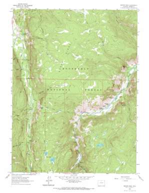
Boston Peak Topo Map Colorado
To zoom in, hover over the map of Boston Peak
USGS Topo Quad 40105f7 - 1:24,000 scale
| Topo Map Name: | Boston Peak |
| USGS Topo Quad ID: | 40105f7 |
| Print Size: | ca. 21 1/4" wide x 27" high |
| Southeast Coordinates: | 40.625° N latitude / 105.75° W longitude |
| Map Center Coordinates: | 40.6875° N latitude / 105.8125° W longitude |
| U.S. State: | CO |
| Filename: | o40105f7.jpg |
| Download Map JPG Image: | Boston Peak topo map 1:24,000 scale |
| Map Type: | Topographic |
| Topo Series: | 7.5´ |
| Map Scale: | 1:24,000 |
| Source of Map Images: | United States Geological Survey (USGS) |
| Alternate Map Versions: |
Boston Peak CO 1962, updated 1964 Download PDF Buy paper map Boston Peak CO 1962, updated 1969 Download PDF Buy paper map Boston Peak CO 2011 Download PDF Buy paper map Boston Peak CO 2013 Download PDF Buy paper map Boston Peak CO 2016 Download PDF Buy paper map |
| FStopo: | US Forest Service topo Boston Peak is available: Download FStopo PDF Download FStopo TIF |
1:24,000 Topo Quads surrounding Boston Peak
> Back to 40105e1 at 1:100,000 scale
> Back to 40104a1 at 1:250,000 scale
> Back to U.S. Topo Maps home
Boston Peak topo map: Gazetteer
Boston Peak: Canals
Rawah and Lower Supply Ditch elevation 2650m 8694′Skyline Ditch elevation 2802m 9192′
Boston Peak: Falls
Poudre Falls elevation 2622m 8602′Boston Peak: Flats
Liebey Park elevation 3059m 10036′Boston Peak: Lakes
Emerald Lake elevation 2911m 9550′Lily Pond Lake elevation 2598m 8523′
Twin Lakes elevation 2900m 9514′
Boston Peak: Mines
Lucky Strike Claims elevation 2823m 9261′Boston Peak: Populated Places
Reds Place elevation 2562m 8405′Spencer Heights elevation 2409m 7903′
Boston Peak: Ridges
Green Ridge elevation 3100m 10170′Boston Peak: Streams
Brinker Creek elevation 2563m 8408′Fall Creek elevation 2572m 8438′
Half Mile Creek elevation 2605m 8546′
Jimmy Creek elevation 2560m 8398′
Joe Wright Creek elevation 2563m 8408′
Mill Creek elevation 2595m 8513′
North Fork Fall Creek elevation 2572m 8438′
Rapid Creek elevation 2572m 8438′
Sheep Creek elevation 2376m 7795′
South Fork Fall Creek elevation 2572m 8438′
Springer Creek elevation 2571m 8435′
Tunnel Creek elevation 2448m 8031′
Two and One Half Creek elevation 2657m 8717′
Boston Peak: Summits
Boston Peak elevation 2850m 9350′Sleeping Elephant Mountain elevation 2770m 9087′
Boston Peak: Trails
Green Ridge Trail elevation 3097m 10160′Roaring Fork Trail elevation 2720m 8923′
Zimmerman Trail elevation 3086m 10124′
Boston Peak: Tunnels
Laramie Poudre Tunnel elevation 2880m 9448′Boston Peak: Valleys
Williams Gulch elevation 2379m 7805′Boston Peak digital topo map on disk
Buy this Boston Peak topo map showing relief, roads, GPS coordinates and other geographical features, as a high-resolution digital map file on DVD:


