Round Butte Topo Map Colorado
To zoom in, hover over the map of Round Butte
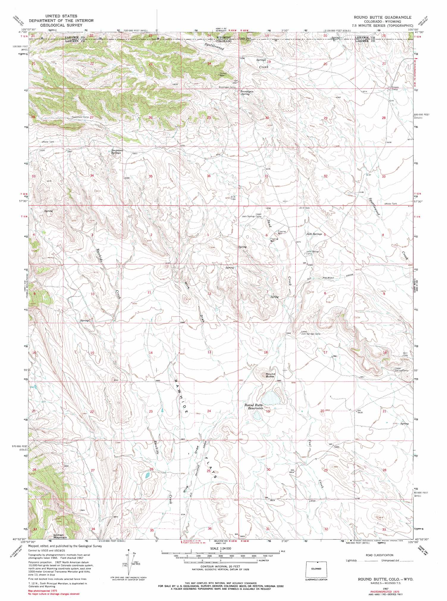
USGS Topo Quad 40105h1 - 1:24,000 scale
| Topo Map Name: | Round Butte |
| USGS Topo Quad ID: | 40105h1 |
| Print Size: | ca. 21 1/4" wide x 27" high |
| Southeast Coordinates: | 40.875° N latitude / 105° W longitude |
| Map Center Coordinates: | 40.9375° N latitude / 105.0625° W longitude |
| U.S. States: | CO, WY |
| Filename: | o40105h1.jpg |
| Download Map JPG Image: | Round Butte topo map 1:24,000 scale |
| Map Type: | Topographic |
| Topo Series: | 7.5´ |
| Map Scale: | 1:24,000 |
| Source of Map Images: | United States Geological Survey (USGS) |
| Alternate Map Versions: |
Round Butte CO 1967, updated 1971 Download PDF Buy paper map Round Butte CO 1967, updated 1971 Download PDF Buy paper map Round Butte CO 1967, updated 1978 Download PDF Buy paper map Round Butte CO 2010 Download PDF Buy paper map Round Butte CO 2013 Download PDF Buy paper map Round Butte CO 2016 Download PDF Buy paper map |
1:24,000 Topo Quads surrounding Round Butte
Sherman Mountains East |
Hecla |
Silver Crown |
Round Top Lake |
Cheyenne North |
Buford |
Granite |
Emkay |
Borie |
Cheyenne South |
Virginia Dale |
Table Mountain |
Round Butte |
Carr West |
Carr East |
Livermore Mountain |
Livermore |
Buckeye |
Carr Sw |
Dover |
Poudre Park |
Laporte |
Wellington |
Cobb Lake |
Nunn |
> Back to 40105e1 at 1:100,000 scale
> Back to 40104a1 at 1:250,000 scale
> Back to U.S. Topo Maps home
Round Butte topo map: Gazetteer
Round Butte: Airports
Rawhide Strip elevation 1787m 5862′Round Butte: Dams
Mountain Supply Number 1 Dam elevation 1790m 5872′Round Butte: Flats
Rawhide Flats elevation 1769m 5803′Round Butte: Reservoirs
Mountain Supply Reservoir Number 1 elevation 1790m 5872′Round Butte Reservoir elevation 1788m 5866′
Round Butte: Springs
Brannigan Spring elevation 1981m 6499′Jack Springs elevation 1852m 6076′
Soapstone Springs elevation 1983m 6505′
Round Butte: Streams
Sand Creek elevation 1792m 5879′Spottlewood Creek elevation 1846m 6056′
Round Butte: Summits
Round Butte elevation 1844m 6049′Round Butte digital topo map on disk
Buy this Round Butte topo map showing relief, roads, GPS coordinates and other geographical features, as a high-resolution digital map file on DVD: