Gore Mountain Topo Map Colorado
To zoom in, hover over the map of Gore Mountain
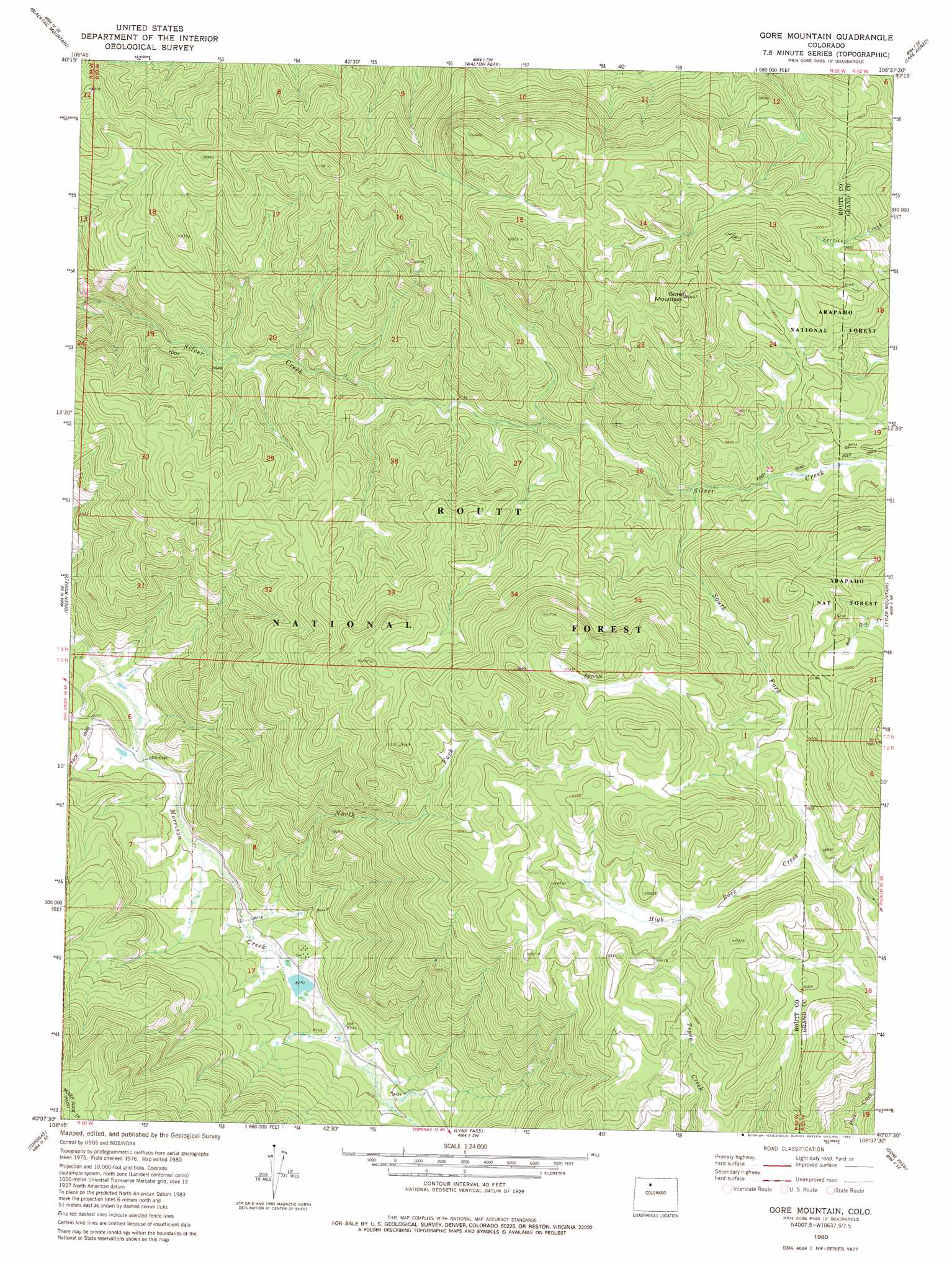
USGS Topo Quad 40106b6 - 1:24,000 scale
| Topo Map Name: | Gore Mountain |
| USGS Topo Quad ID: | 40106b6 |
| Print Size: | ca. 21 1/4" wide x 27" high |
| Southeast Coordinates: | 40.125° N latitude / 106.625° W longitude |
| Map Center Coordinates: | 40.1875° N latitude / 106.6875° W longitude |
| U.S. State: | CO |
| Filename: | o40106b6.jpg |
| Download Map JPG Image: | Gore Mountain topo map 1:24,000 scale |
| Map Type: | Topographic |
| Topo Series: | 7.5´ |
| Map Scale: | 1:24,000 |
| Source of Map Images: | United States Geological Survey (USGS) |
| Alternate Map Versions: |
Gore Mountain CO 1980, updated 1980 Download PDF Buy paper map Gore Mountain CO 1980, updated 1983 Download PDF Buy paper map Gore Mountain CO 2000, updated 2004 Download PDF Buy paper map Gore Mountain CO 2011 Download PDF Buy paper map Gore Mountain CO 2013 Download PDF Buy paper map Gore Mountain CO 2016 Download PDF Buy paper map |
| FStopo: | US Forest Service topo Gore Mountain is available: Download FStopo PDF Download FStopo TIF |
1:24,000 Topo Quads surrounding Gore Mountain
Cow Creek |
Steamboat Springs |
Mount Werner |
Rabbit Ears Peak |
Spicer Peak |
Oak Creek |
Blacktail Mountain |
Walton Peak |
Lake Agnes |
Whiteley Peak |
Yampa |
Green Ridge |
Gore Mountain |
Tyler Mountain |
Hinman Reservoir |
Trapper |
Toponas |
Lynx Pass |
Gore Pass |
Kremmling |
Burns North |
Blue Hill |
Mccoy |
Radium |
Sheephorn Mountain |
> Back to 40106a1 at 1:100,000 scale
> Back to 40106a1 at 1:250,000 scale
> Back to U.S. Topo Maps home
Gore Mountain topo map: Gazetteer
Gore Mountain: Streams
Muddy Creek elevation 2467m 8093′North Fork Morrison Creek elevation 2506m 8221′
South Fork Silver Creek elevation 2880m 9448′
Gore Mountain: Summits
Gore Mountain elevation 3237m 10620′Gore Mountain digital topo map on disk
Buy this Gore Mountain topo map showing relief, roads, GPS coordinates and other geographical features, as a high-resolution digital map file on DVD: