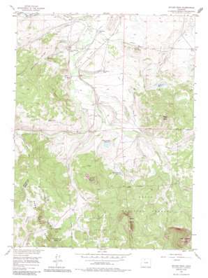
Spicer Peak Topo Map Colorado
To zoom in, hover over the map of Spicer Peak
USGS Topo Quad 40106d4 - 1:24,000 scale
| Topo Map Name: | Spicer Peak |
| USGS Topo Quad ID: | 40106d4 |
| Print Size: | ca. 21 1/4" wide x 27" high |
| Southeast Coordinates: | 40.375° N latitude / 106.375° W longitude |
| Map Center Coordinates: | 40.4375° N latitude / 106.4375° W longitude |
| U.S. State: | CO |
| Filename: | o40106d4.jpg |
| Download Map JPG Image: | Spicer Peak topo map 1:24,000 scale |
| Map Type: | Topographic |
| Topo Series: | 7.5´ |
| Map Scale: | 1:24,000 |
| Source of Map Images: | United States Geological Survey (USGS) |
| Alternate Map Versions: |
Spicer Peak CO 1956, updated 1958 Download PDF Buy paper map Spicer Peak CO 1956, updated 1958 Download PDF Buy paper map Spicer Peak CO 1956, updated 1965 Download PDF Buy paper map Spicer Peak CO 1956, updated 1973 Download PDF Buy paper map Spicer Peak CO 1956, updated 1985 Download PDF Buy paper map Spicer Peak CO 2000, updated 2004 Download PDF Buy paper map Spicer Peak CO 2011 Download PDF Buy paper map Spicer Peak CO 2013 Download PDF Buy paper map Spicer Peak CO 2016 Download PDF Buy paper map |
| FStopo: | US Forest Service topo Spicer Peak is available: Download FStopo PDF Download FStopo TIF |
1:24,000 Topo Quads surrounding Spicer Peak
> Back to 40106a1 at 1:100,000 scale
> Back to 40106a1 at 1:250,000 scale
> Back to U.S. Topo Maps home
Spicer Peak topo map: Gazetteer
Spicer Peak: Canals
Arapaho Ditch elevation 2593m 8507′Arapaho Ditch elevation 2550m 8366′
Eureka Ditch elevation 2549m 8362′
Jordan Ditch elevation 2579m 8461′
Koping Ditch elevation 2513m 8244′
Larsen Ditch elevation 2529m 8297′
Lawrence Number 1 Ditch elevation 2566m 8418′
Martin Ditch elevation 2522m 8274′
Seymour Ditch Number 2 elevation 2519m 8264′
Surprise Ditch elevation 2525m 8284′
Titantic Ditch elevation 2639m 8658′
Waste Ditch elevation 2540m 8333′
Spicer Peak: Cliffs
Dennis Hump elevation 3008m 9868′Spicer Peak: Dams
Coyte Dam elevation 2521m 8270′Hecla Dam elevation 2621m 8599′
Mexican Creek Dam elevation 2534m 8313′
Seymour Dam elevation 2543m 8343′
Van Valkenburg Dam elevation 2559m 8395′
Wade Dam elevation 2556m 8385′
West Arapahoe Dam elevation 2584m 8477′
Spicer Peak: Gaps
Arapaho Pass elevation 2729m 8953′Spicer Peak: Lakes
Kidney Lake elevation 2629m 8625′Spicer Peak: Reservoirs
Coyte Reservoir elevation 2521m 8270′Hecla Reservoir elevation 2621m 8599′
Mexican Reservoir elevation 2534m 8313′
Seymour Lake elevation 2543m 8343′
South Arapaho Reservoir elevation 2638m 8654′
Van Valkenburg Reservoir elevation 2559m 8395′
Wade Lake elevation 2556m 8385′
West Arapaho Reservoir elevation 2589m 8494′
Spicer Peak: Streams
Arapaho Creek elevation 2528m 8293′Indian Creek elevation 2560m 8398′
Middle Fork Arapaho Creek elevation 2660m 8727′
Middle Fork Mexican Creek elevation 2536m 8320′
Ninegar Creek elevation 2610m 8562′
South Fork Arapaho Creek elevation 2660m 8727′
South Fork Mexican Creek elevation 2518m 8261′
Spicer Peak: Summits
Ironclad Mountain elevation 2854m 9363′Little Haystack Mountain elevation 3248m 10656′
Spicer Peak elevation 2920m 9580′
Spicer Peak: Valleys
Ed Van Draw elevation 2527m 8290′Horseshoe Bend Draw elevation 2555m 8382′
Spicer Peak digital topo map on disk
Buy this Spicer Peak topo map showing relief, roads, GPS coordinates and other geographical features, as a high-resolution digital map file on DVD:


