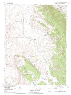
Johnny Moore Mountain Topo Map Colorado
To zoom in, hover over the map of Johnny Moore Mountain
USGS Topo Quad 40106f1 - 1:24,000 scale
| Topo Map Name: | Johnny Moore Mountain |
| USGS Topo Quad ID: | 40106f1 |
| Print Size: | ca. 21 1/4" wide x 27" high |
| Southeast Coordinates: | 40.625° N latitude / 106° W longitude |
| Map Center Coordinates: | 40.6875° N latitude / 106.0625° W longitude |
| U.S. State: | CO |
| Filename: | o40106f1.jpg |
| Download Map JPG Image: | Johnny Moore Mountain topo map 1:24,000 scale |
| Map Type: | Topographic |
| Topo Series: | 7.5´ |
| Map Scale: | 1:24,000 |
| Source of Map Images: | United States Geological Survey (USGS) |
| Alternate Map Versions: |
Johnny Moore Mountain CO 1956, updated 1958 Download PDF Buy paper map Johnny Moore Mountain CO 1956, updated 1958 Download PDF Buy paper map Johnny Moore Mountain CO 1956, updated 1963 Download PDF Buy paper map Johnny Moore Mountain CO 1956, updated 1963 Download PDF Buy paper map Johnny Moore Mountain CO 1956, updated 1972 Download PDF Buy paper map Johnny Moore Mountain CO 1956, updated 1991 Download PDF Buy paper map Johnny Moore Mountain CO 1956, updated 1991 Download PDF Buy paper map Johnny Moore Mountain CO 2000, updated 2004 Download PDF Buy paper map Johnny Moore Mountain CO 2011 Download PDF Buy paper map Johnny Moore Mountain CO 2013 Download PDF Buy paper map Johnny Moore Mountain CO 2016 Download PDF Buy paper map |
| FStopo: | US Forest Service topo Johnny Moore Mountain is available: Download FStopo PDF Download FStopo TIF |
1:24,000 Topo Quads surrounding Johnny Moore Mountain
> Back to 40106e1 at 1:100,000 scale
> Back to 40106a1 at 1:250,000 scale
> Back to U.S. Topo Maps home
Johnny Moore Mountain topo map: Gazetteer
Johnny Moore Mountain: Canals
Bonafide Ditch elevation 2531m 8303′Bonafide Ditch Number 2 elevation 2567m 8421′
Carpenter Ditch Number 1 elevation 2470m 8103′
Dale Ditch elevation 2563m 8408′
Fernando Ditch elevation 2483m 8146′
Gillette Ditch Number 1 elevation 2566m 8418′
Gillette Ditch Number 2 elevation 2507m 8225′
Gillette Ditch Number 3 elevation 2562m 8405′
Kelley Ditch elevation 2560m 8398′
Kelley Highline and Kermode Ditch Number 2 elevation 2606m 8549′
Kenney Ditch elevation 2475m 8120′
Pomroy Ditch elevation 2493m 8179′
Pomroy Ditch Number 2 elevation 2482m 8143′
Smith Ditch elevation 2614m 8576′
Spear and Michigan Highline Ditch elevation 2580m 8464′
Spear Ditch elevation 2556m 8385′
Sudduth Ditch Number 1 elevation 2514m 8248′
Toledo Ditch elevation 2559m 8395′
Troublesome Ditch elevation 2476m 8123′
Vita Ditch elevation 2590m 8497′
Johnny Moore Mountain: Flats
Brown Park elevation 2615m 8579′Muddy Park elevation 2677m 8782′
Johnny Moore Mountain: Mines
Canadian Strip Mine elevation 2497m 8192′Kerr Mine elevation 2509m 8231′
Lang Prospect elevation 2486m 8156′
Marr Mine elevation 2514m 8248′
Marr Mines elevation 2501m 8205′
Winscom Mine elevation 2519m 8264′
Johnny Moore Mountain: Streams
Allen Creek elevation 2469m 8100′Clear Creek elevation 2506m 8221′
Dry Creek elevation 2601m 8533′
Kelly Creek elevation 2533m 8310′
McKenzie Creek elevation 2468m 8097′
McNally Creek elevation 2458m 8064′
Muddy Creek elevation 2498m 8195′
Willow Creek elevation 2512m 8241′
Johnny Moore Mountain: Summits
Elk Mountain elevation 2685m 8809′Johnny Moore Mountain elevation 2755m 9038′
Johnny Moore Mountain: Trails
Jack Dickens Trail elevation 2826m 9271′Johnny Moore Mountain: Valleys
Bottom Draw elevation 2472m 8110′Bush Draw elevation 2459m 8067′
Cat Canyon elevation 2510m 8234′
Johnny Moore Mountain digital topo map on disk
Buy this Johnny Moore Mountain topo map showing relief, roads, GPS coordinates and other geographical features, as a high-resolution digital map file on DVD:


