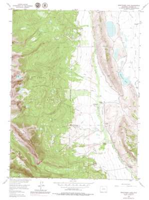
Boettcher Lake Topo Map Colorado
To zoom in, hover over the map of Boettcher Lake
USGS Topo Quad 40106g5 - 1:24,000 scale
| Topo Map Name: | Boettcher Lake |
| USGS Topo Quad ID: | 40106g5 |
| Print Size: | ca. 21 1/4" wide x 27" high |
| Southeast Coordinates: | 40.75° N latitude / 106.5° W longitude |
| Map Center Coordinates: | 40.8125° N latitude / 106.5625° W longitude |
| U.S. State: | CO |
| Filename: | o40106g5.jpg |
| Download Map JPG Image: | Boettcher Lake topo map 1:24,000 scale |
| Map Type: | Topographic |
| Topo Series: | 7.5´ |
| Map Scale: | 1:24,000 |
| Source of Map Images: | United States Geological Survey (USGS) |
| Alternate Map Versions: |
Boettcher Lake CO 1956, updated 1957 Download PDF Buy paper map Boettcher Lake CO 1956, updated 1957 Download PDF Buy paper map Boettcher Lake CO 1956, updated 1963 Download PDF Buy paper map Boettcher Lake CO 1956, updated 1963 Download PDF Buy paper map Boettcher Lake CO 1956, updated 1972 Download PDF Buy paper map Boettcher Lake CO 1956, updated 1972 Download PDF Buy paper map Boettcher Lake CO 1956, updated 1979 Download PDF Buy paper map Boettcher Lake CO 1956, updated 1979 Download PDF Buy paper map Boettcher Lake CO 2000, updated 2004 Download PDF Buy paper map Boettcher Lake CO 2011 Download PDF Buy paper map Boettcher Lake CO 2013 Download PDF Buy paper map Boettcher Lake CO 2016 Download PDF Buy paper map |
| FStopo: | US Forest Service topo Boettcher Lake is available: Download FStopo PDF Download FStopo TIF |
1:24,000 Topo Quads surrounding Boettcher Lake
> Back to 40106e1 at 1:100,000 scale
> Back to 40106a1 at 1:250,000 scale
> Back to U.S. Topo Maps home
Boettcher Lake topo map: Gazetteer
Boettcher Lake: Canals
Bear Creek Ditch elevation 2560m 8398′Boulder Ditch elevation 2564m 8412′
Dry Run Ditch elevation 2565m 8415′
Eber Ditch elevation 2554m 8379′
First Run Ditch elevation 2546m 8353′
Haworth Ditch Number 1 elevation 2576m 8451′
Haworth Ditch Number 2 elevation 2541m 8336′
Hill Ditch Number 2 elevation 2491m 8172′
Lake Creek Ditch elevation 2539m 8330′
Lookout Ditch elevation 2705m 8874′
Marble Dow Ditch elevation 2574m 8444′
North Fork Ditch elevation 2531m 8303′
Shafer Ditch elevation 2598m 8523′
Stormy Ditch elevation 2597m 8520′
Sunrise Ditch elevation 2580m 8464′
West Boettcher Ditch elevation 2611m 8566′
Zirkel Ditch elevation 2564m 8412′
Boettcher Lake: Flats
Elk Park elevation 2806m 9206′Boettcher Lake: Lakes
Blue Lake elevation 2993m 9819′Boettcher Lake elevation 2467m 8093′
Twin Lake elevation 3015m 9891′
Ute Lake elevation 2974m 9757′
Boettcher Lake: Mines
Bear Creek Mine elevation 2930m 9612′Monahan Mine elevation 2541m 8336′
Boettcher Lake: Populated Places
Fort Boettcher elevation 2538m 8326′Boettcher Lake: Reservoirs
Brands Reservoir elevation 2691m 8828′Boettcher Lake: Streams
Bear Creek elevation 2519m 8264′Brown Creek elevation 2529m 8297′
Dry Run elevation 2513m 8244′
Goose Creek elevation 2581m 8467′
Hill Creek elevation 2541m 8336′
Lake Creek elevation 2537m 8323′
Mable Dow Ditch elevation 2576m 8451′
Monahan Creek elevation 2555m 8382′
Shafer Creek elevation 2573m 8441′
Ute Creek elevation 2536m 8320′
Boettcher Lake: Summits
Bear Mountain elevation 3535m 11597′Sheep Mountain elevation 2860m 9383′
Boettcher Lake: Trails
Blue Lake Trail elevation 2812m 9225′Fryingpan Trail elevation 2850m 9350′
Grizzly Helena Trail elevation 2758m 9048′
Twin Lake Trail elevation 2875m 9432′
Ute Pass Trail elevation 2907m 9537′
Boettcher Lake: Valleys
Lawrence Draw elevation 2470m 8103′Boettcher Lake digital topo map on disk
Buy this Boettcher Lake topo map showing relief, roads, GPS coordinates and other geographical features, as a high-resolution digital map file on DVD:


