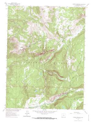
Farwell Mountain Topo Map Colorado
To zoom in, hover over the map of Farwell Mountain
USGS Topo Quad 40106g7 - 1:24,000 scale
| Topo Map Name: | Farwell Mountain |
| USGS Topo Quad ID: | 40106g7 |
| Print Size: | ca. 21 1/4" wide x 27" high |
| Southeast Coordinates: | 40.75° N latitude / 106.75° W longitude |
| Map Center Coordinates: | 40.8125° N latitude / 106.8125° W longitude |
| U.S. State: | CO |
| Filename: | o40106g7.jpg |
| Download Map JPG Image: | Farwell Mountain topo map 1:24,000 scale |
| Map Type: | Topographic |
| Topo Series: | 7.5´ |
| Map Scale: | 1:24,000 |
| Source of Map Images: | United States Geological Survey (USGS) |
| Alternate Map Versions: |
Farwell Mountain CO 1962, updated 1964 Download PDF Buy paper map Farwell Mountain CO 1962, updated 1964 Download PDF Buy paper map Farwell Mountain CO 1962, updated 1971 Download PDF Buy paper map Farwell Mountain CO 2000, updated 2004 Download PDF Buy paper map Farwell Mountain CO 2011 Download PDF Buy paper map Farwell Mountain CO 2013 Download PDF Buy paper map Farwell Mountain CO 2016 Download PDF Buy paper map |
| FStopo: | US Forest Service topo Farwell Mountain is available: Download FStopo PDF Download FStopo TIF |
1:24,000 Topo Quads surrounding Farwell Mountain
> Back to 40106e1 at 1:100,000 scale
> Back to 40106a1 at 1:250,000 scale
> Back to U.S. Topo Maps home
Farwell Mountain topo map: Gazetteer
Farwell Mountain: Flats
Boulder Park elevation 2384m 7821′Diamond Park elevation 2660m 8727′
Hinman Park elevation 2343m 7687′
Farwell Mountain: Lakes
Farwell Lake elevation 2888m 9475′Farwell Mountain: Mines
Farwell Mountain Northwest Mine elevation 3113m 10213′King Solomon Creek Mine elevation 2892m 9488′
Zinc Mountain Mine elevation 2881m 9452′
Farwell Mountain: Streams
Agnes Creek elevation 2647m 8684′English Creek elevation 2479m 8133′
Farwell Creek elevation 2775m 9104′
Hinman Creek elevation 2318m 7604′
Lost Dog Creek elevation 2502m 8208′
Middle Fork Elk River elevation 2442m 8011′
North Fork Elk Creek elevation 2433m 7982′
North Three Island Creek elevation 2545m 8349′
Scott Run elevation 2462m 8077′
South Fork Elk River elevation 2341m 7680′
Stevens Creek elevation 2624m 8608′
Trail Creek elevation 2592m 8503′
Farwell Mountain: Summits
Dome Peak elevation 3138m 10295′Farwell Mountain elevation 3309m 10856′
Farwell Mountain: Trails
Coulton Creek Trail elevation 2491m 8172′Hinman Creek Trail elevation 2560m 8398′
Farwell Mountain: Valleys
Box Canyon elevation 2630m 8628′Hinman Canyon elevation 2557m 8389′
Hole-in-Wall Canyon elevation 2451m 8041′
Farwell Mountain digital topo map on disk
Buy this Farwell Mountain topo map showing relief, roads, GPS coordinates and other geographical features, as a high-resolution digital map file on DVD:


