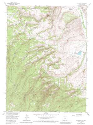
Old Roach Topo Map Colorado
To zoom in, hover over the map of Old Roach
USGS Topo Quad 40106h1 - 1:24,000 scale
| Topo Map Name: | Old Roach |
| USGS Topo Quad ID: | 40106h1 |
| Print Size: | ca. 21 1/4" wide x 27" high |
| Southeast Coordinates: | 40.875° N latitude / 106° W longitude |
| Map Center Coordinates: | 40.9375° N latitude / 106.0625° W longitude |
| U.S. States: | CO, WY |
| Filename: | o40106h1.jpg |
| Download Map JPG Image: | Old Roach topo map 1:24,000 scale |
| Map Type: | Topographic |
| Topo Series: | 7.5´ |
| Map Scale: | 1:24,000 |
| Source of Map Images: | United States Geological Survey (USGS) |
| Alternate Map Versions: |
Old Roach CO 1955, updated 1957 Download PDF Buy paper map Old Roach CO 1955, updated 1964 Download PDF Buy paper map Old Roach CO 1955, updated 1964 Download PDF Buy paper map Old Roach CO 1955, updated 1970 Download PDF Buy paper map Old Roach CO 1955, updated 1970 Download PDF Buy paper map Old Roach CO 2011 Download PDF Buy paper map Old Roach CO 2013 Download PDF Buy paper map Old Roach CO 2016 Download PDF Buy paper map |
| FStopo: | US Forest Service topo Old Roach is available: Download FStopo PDF Download FStopo TIF |
1:24,000 Topo Quads surrounding Old Roach
> Back to 40106e1 at 1:100,000 scale
> Back to 40106a1 at 1:250,000 scale
> Back to U.S. Topo Maps home
Old Roach topo map: Gazetteer
Old Roach: Canals
Bliler and Boswell Ditch elevation 2352m 7716′Grace Creek Ditch elevation 2413m 7916′
Hance Ditch elevation 2366m 7762′
Slough Creek Ditch elevation 2395m 7857′
Stuck Creek Ditch elevation 2352m 7716′
Stuck Creek Ditch elevation 2354m 7723′
Warren Ditch elevation 2360m 7742′
Old Roach: Dams
Johnson Dam elevation 2411m 7910′Old Roach: Populated Places
Old Roach elevation 2859m 9379′Old Roach: Reservoirs
Johnson Reservoir elevation 2411m 7910′Old Roach: Streams
Fish Creek elevation 2505m 8218′Maggie Creek elevation 2348m 7703′
Maggie Creek elevation 2345m 7693′
Middle Fork Grace Creek elevation 2616m 8582′
North Fork Grace Creek elevation 2515m 8251′
Pole Creek elevation 2425m 7956′
Slough Creek elevation 2377m 7798′
South Fork Grace Creek elevation 2515m 8251′
Stuck Creek elevation 2348m 7703′
Old Roach: Summits
Mansfield Hill elevation 2952m 9685′Pollock Knob elevation 2990m 9809′
Old Roach digital topo map on disk
Buy this Old Roach topo map showing relief, roads, GPS coordinates and other geographical features, as a high-resolution digital map file on DVD:


