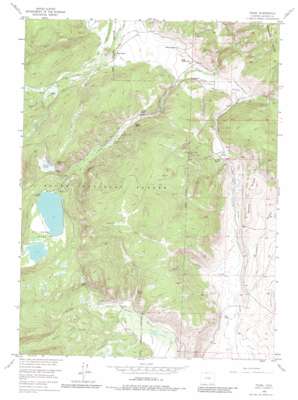
Pearl Topo Map Colorado
To zoom in, hover over the map of Pearl
USGS Topo Quad 40106h5 - 1:24,000 scale
| Topo Map Name: | Pearl |
| USGS Topo Quad ID: | 40106h5 |
| Print Size: | ca. 21 1/4" wide x 27" high |
| Southeast Coordinates: | 40.875° N latitude / 106.5° W longitude |
| Map Center Coordinates: | 40.9375° N latitude / 106.5625° W longitude |
| U.S. State: | CO |
| Filename: | o40106h5.jpg |
| Download Map JPG Image: | Pearl topo map 1:24,000 scale |
| Map Type: | Topographic |
| Topo Series: | 7.5´ |
| Map Scale: | 1:24,000 |
| Source of Map Images: | United States Geological Survey (USGS) |
| Alternate Map Versions: |
Pearl CO 1955, updated 1957 Download PDF Buy paper map Pearl CO 1955, updated 1957 Download PDF Buy paper map Pearl CO 1955, updated 1964 Download PDF Buy paper map Pearl CO 1955, updated 1971 Download PDF Buy paper map Pearl CO 1955, updated 1980 Download PDF Buy paper map Pearl CO 2000, updated 2004 Download PDF Buy paper map Pearl CO 2011 Download PDF Buy paper map Pearl CO 2013 Download PDF Buy paper map Pearl CO 2016 Download PDF Buy paper map |
| FStopo: | US Forest Service topo Pearl is available: Download FStopo PDF Download FStopo TIF |
1:24,000 Topo Quads surrounding Pearl
> Back to 40106e1 at 1:100,000 scale
> Back to 40106a1 at 1:250,000 scale
> Back to U.S. Topo Maps home
Pearl topo map: Gazetteer
Pearl: Canals
Akers Ditch elevation 2572m 8438′Albert Clauson Ditch elevation 2573m 8441′
Beaverdale Ditch elevation 2607m 8553′
Bighorn Cattle Company Ditch elevation 2553m 8375′
Carney Ditch elevation 2566m 8418′
East Lynn Ditch elevation 2584m 8477′
Hans Clauson Number 1 Ditch elevation 2599m 8526′
Hans Clauson Number 2 Ditch elevation 2571m 8435′
Hill Ditch Number 1 elevation 2507m 8225′
Independence Ditch elevation 2730m 8956′
Plainwell Ditch elevation 2557m 8389′
Pleasant Valley Ditch elevation 2718m 8917′
Rhea Ditch elevation 2619m 8592′
Wheeler Ditch elevation 2560m 8398′
Pearl: Lakes
Big Creek Lakes elevation 2745m 9005′Pearl: Mines
Gold King Shaft elevation 2720m 8923′Grand Republic Mine elevation 2733m 8966′
Sierra Madre Shaft elevation 2562m 8405′
Swede Group Mines elevation 2734m 8969′
Wolverine Mine elevation 2628m 8622′
Zirkel Mine elevation 2629m 8625′
Pearl: Populated Places
Pearl elevation 2562m 8405′Pearl: Post Offices
Pearl Post Office (historical) elevation 2562m 8405′Pearl: Ridges
Battle Ridge elevation 2629m 8625′Pearl: Streams
Forrester Creek elevation 2612m 8569′Republic Creek elevation 2513m 8244′
Rhea Creek elevation 2595m 8513′
Wheeler Creek elevation 2541m 8336′
Pearl: Summits
Bear Mountain elevation 2567m 8421′Pearl: Swamps
Twisty Park elevation 2710m 8891′Pearl: Valleys
Trappers Gulch elevation 2508m 8228′Troutman Draw elevation 2558m 8392′
Pearl digital topo map on disk
Buy this Pearl topo map showing relief, roads, GPS coordinates and other geographical features, as a high-resolution digital map file on DVD:


