Ninemile Gap Topo Map Colorado
To zoom in, hover over the map of Ninemile Gap
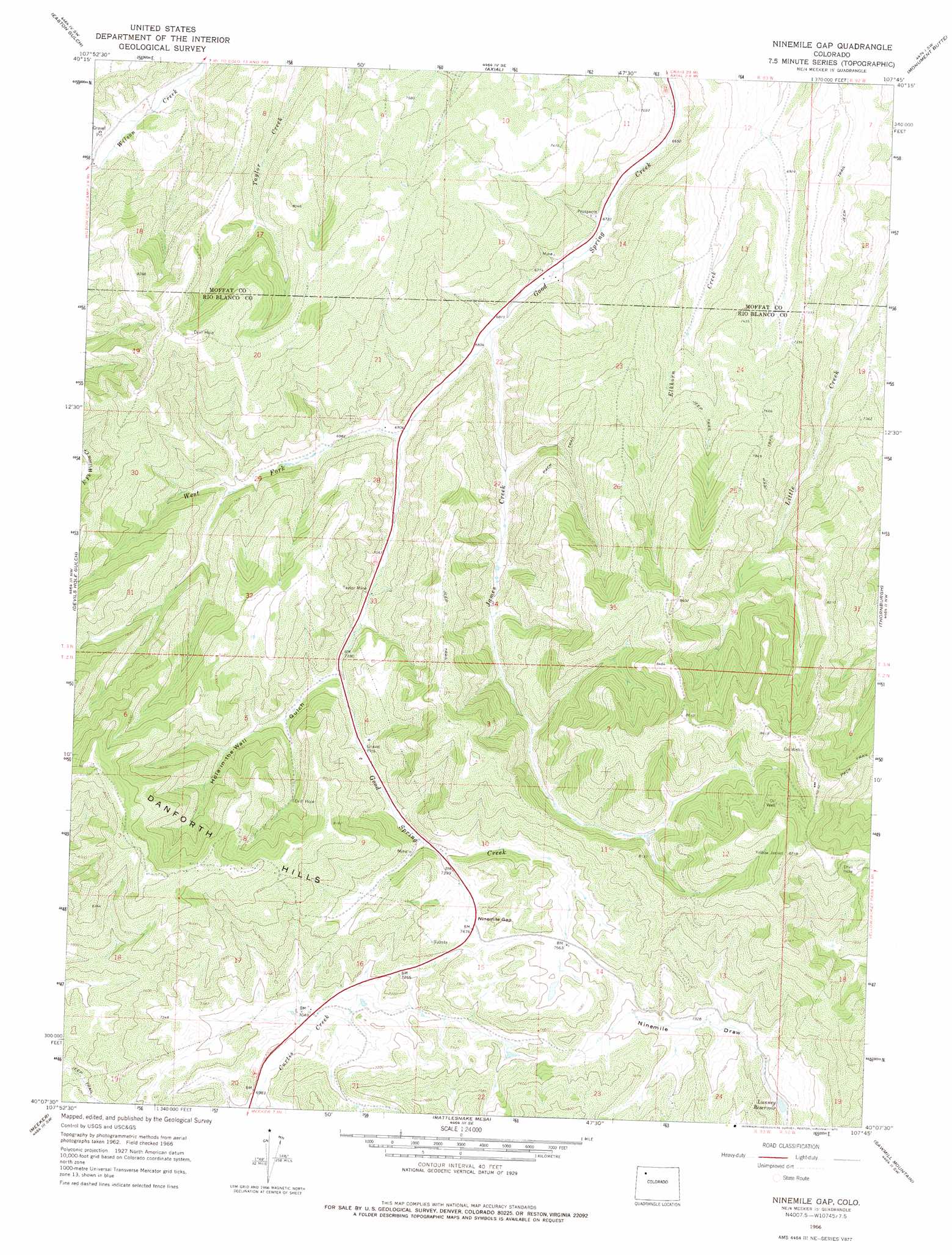
USGS Topo Quad 40107b7 - 1:24,000 scale
| Topo Map Name: | Ninemile Gap |
| USGS Topo Quad ID: | 40107b7 |
| Print Size: | ca. 21 1/4" wide x 27" high |
| Southeast Coordinates: | 40.125° N latitude / 107.75° W longitude |
| Map Center Coordinates: | 40.1875° N latitude / 107.8125° W longitude |
| U.S. State: | CO |
| Filename: | o40107b7.jpg |
| Download Map JPG Image: | Ninemile Gap topo map 1:24,000 scale |
| Map Type: | Topographic |
| Topo Series: | 7.5´ |
| Map Scale: | 1:24,000 |
| Source of Map Images: | United States Geological Survey (USGS) |
| Alternate Map Versions: |
Ninemile Gap CO 1966, updated 1969 Download PDF Buy paper map Ninemile Gap CO 1966, updated 1969 Download PDF Buy paper map Ninemile Gap CO 1966, updated 1975 Download PDF Buy paper map Ninemile Gap CO 2010 Download PDF Buy paper map Ninemile Gap CO 2013 Download PDF Buy paper map Ninemile Gap CO 2016 Download PDF Buy paper map |
1:24,000 Topo Quads surrounding Ninemile Gap
Juniper Mountain |
Juniper Hot Springs |
Horse Gulch |
Round Bottom |
Castor Gulch |
Price Creek |
Easton Gulch |
Axial |
Monument Butte |
Hamilton |
White Rock |
Devils Hole Gulch |
Ninemile Gap |
Thornburgh |
Sleepy Cat Peak |
Buckskin Point |
Meeker |
Rattlesnake Mesa |
Sawmill Mountain |
Fawn Creek |
Segar Mountain |
Lo 7 Hill |
Veatch Gulch |
Big Beaver Reservoir |
Buford |
> Back to 40107a1 at 1:100,000 scale
> Back to 40106a1 at 1:250,000 scale
> Back to U.S. Topo Maps home
Ninemile Gap topo map: Gazetteer
Ninemile Gap: Airports
Teepee Park Heliport elevation 2462m 8077′Ninemile Gap: Dams
Lunney Dam elevation 2176m 7139′Ninemile Gap: Gaps
Ninemile Gap elevation 2280m 7480′Ninemile Gap: Mines
Frank Pollard Mine elevation 2262m 7421′Gentry Mine elevation 2307m 7568′
James Mine elevation 2110m 6922′
Shiloh Number One Mine elevation 2269m 7444′
Taylor Mine elevation 2191m 7188′
Ninemile Gap: Reservoirs
Lunney Reservoir elevation 2176m 7139′Ninemile Gap: Streams
James Creek elevation 2078m 6817′Taylor Creek elevation 2513m 8244′
West Fork Good Spring Creek elevation 2101m 6893′
Ninemile Gap: Valleys
Hole-in-the-Wall Gulch elevation 2198m 7211′Ninemile Gap digital topo map on disk
Buy this Ninemile Gap topo map showing relief, roads, GPS coordinates and other geographical features, as a high-resolution digital map file on DVD: