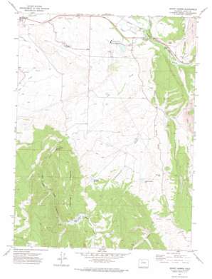
Mount Harris Topo Map Colorado
To zoom in, hover over the map of Mount Harris
USGS Topo Quad 40107d2 - 1:24,000 scale
| Topo Map Name: | Mount Harris |
| USGS Topo Quad ID: | 40107d2 |
| Print Size: | ca. 21 1/4" wide x 27" high |
| Southeast Coordinates: | 40.375° N latitude / 107.125° W longitude |
| Map Center Coordinates: | 40.4375° N latitude / 107.1875° W longitude |
| U.S. State: | CO |
| Filename: | o40107d2.jpg |
| Download Map JPG Image: | Mount Harris topo map 1:24,000 scale |
| Map Type: | Topographic |
| Topo Series: | 7.5´ |
| Map Scale: | 1:24,000 |
| Source of Map Images: | United States Geological Survey (USGS) |
| Alternate Map Versions: |
Mount Harris CO 1971, updated 1974 Download PDF Buy paper map Mount Harris CO 2010 Download PDF Buy paper map Mount Harris CO 2013 Download PDF Buy paper map Mount Harris CO 2016 Download PDF Buy paper map |
1:24,000 Topo Quads surrounding Mount Harris
> Back to 40107a1 at 1:100,000 scale
> Back to 40106a1 at 1:250,000 scale
> Back to U.S. Topo Maps home
Mount Harris topo map: Gazetteer
Mount Harris: Airports
Yampa Valley Airport elevation 2008m 6587′Mount Harris: Canals
Marshall Roberts Ditch elevation 1953m 6407′Shelton Ditch elevation 1930m 6332′
Walker Ditch elevation 1948m 6391′
Mount Harris: Dams
Hayden Plant Evaporation Pond Dam elevation 1983m 6505′Hayden Plant Recycled Water Dam elevation 1983m 6505′
Hayden Station Ash Dam elevation 1981m 6499′
Nofstger Dam elevation 2050m 6725′
Nofstger-Zeigler Dam elevation 2053m 6735′
Sage Creek Dam elevation 2175m 7135′
Walrod Dam elevation 1970m 6463′
Whetstone Number 3 Dam elevation 2064m 6771′
Mount Harris: Gaps
Grassy Gap elevation 2151m 7057′Mount Harris: Mines
Bruce Walter Mine elevation 2076m 6811′Hendricks Mine elevation 2214m 7263′
Mount Harris Mine elevation 1989m 6525′
Peabody Pit elevation 2077m 6814′
Mount Harris: Populated Places
Mount Harris elevation 1963m 6440′Mount Harris: Reservoirs
Ashponds Hayden Station elevation 1981m 6499′Hayden Plant Evaporation Pond elevation 1983m 6505′
Hayden Plant Recycled Water Reservoir elevation 1983m 6505′
J B Dawson Number One Reservoir elevation 2041m 6696′
Nofstger Reservoir elevation 2050m 6725′
Nofstger Zeigler Reservoir elevation 2053m 6735′
Sage Creek Reservoir elevation 2175m 7135′
Walrod Reservoir elevation 1970m 6463′
Whetstone Reservoir Number 3 elevation 2064m 6771′
Mount Harris: Streams
Grassy Creek elevation 1974m 6476′Sage Creek elevation 1952m 6404′
Wolf Creek elevation 1960m 6430′
Mount Harris: Summits
Hillberry Mountain elevation 2334m 7657′Mount Harris: Valleys
Sage Creek Canyon elevation 2024m 6640′Scotchmans Gulch elevation 2005m 6578′
Stokes Gulch elevation 1946m 6384′
Mount Harris digital topo map on disk
Buy this Mount Harris topo map showing relief, roads, GPS coordinates and other geographical features, as a high-resolution digital map file on DVD:


