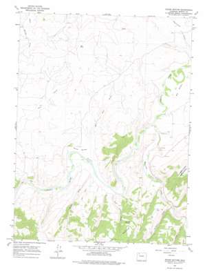
Round Bottom Topo Map Colorado
To zoom in, hover over the map of Round Bottom
USGS Topo Quad 40107d6 - 1:24,000 scale
| Topo Map Name: | Round Bottom |
| USGS Topo Quad ID: | 40107d6 |
| Print Size: | ca. 21 1/4" wide x 27" high |
| Southeast Coordinates: | 40.375° N latitude / 107.625° W longitude |
| Map Center Coordinates: | 40.4375° N latitude / 107.6875° W longitude |
| U.S. State: | CO |
| Filename: | o40107d6.jpg |
| Download Map JPG Image: | Round Bottom topo map 1:24,000 scale |
| Map Type: | Topographic |
| Topo Series: | 7.5´ |
| Map Scale: | 1:24,000 |
| Source of Map Images: | United States Geological Survey (USGS) |
| Alternate Map Versions: |
Round Bottom CO 1966, updated 1970 Download PDF Buy paper map Round Bottom CO 1966, updated 1970 Download PDF Buy paper map Round Bottom CO 1966, updated 1975 Download PDF Buy paper map Round Bottom CO 2010 Download PDF Buy paper map Round Bottom CO 2013 Download PDF Buy paper map Round Bottom CO 2016 Download PDF Buy paper map |
1:24,000 Topo Quads surrounding Round Bottom
> Back to 40107a1 at 1:100,000 scale
> Back to 40106a1 at 1:250,000 scale
> Back to U.S. Topo Maps home
Round Bottom topo map: Gazetteer
Round Bottom: Bends
Big Bottom elevation 1872m 6141′Round Bottom elevation 1861m 6105′
Round Bottom: Dams
Ellgen Dam elevation 1883m 6177′Ellgen Number 2 Dam elevation 1876m 6154′
Round Bottom: Mines
Baker Mine elevation 1949m 6394′Banker Mine elevation 1889m 6197′
Eagle Number Five Mine elevation 1874m 6148′
Eagle Number Nine Mine elevation 1938m 6358′
Fields Mine elevation 2000m 6561′
Hart Mine elevation 1926m 6318′
Haubrich Mine elevation 1895m 6217′
Leon Claims elevation 1899m 6230′
Round Bottom Mine elevation 1953m 6407′
Williamsfork Number One Mine elevation 1998m 6555′
Wise Hill Mine Number Five elevation 1878m 6161′
Round Bottom: Pillars
Bell Rock elevation 1994m 6541′Round Bottom: Reservoirs
Ellgen Reservoir elevation 1883m 6177′Ellgen Reservoir Number 2 elevation 1876m 6154′
Round Bottom: Springs
Post Oak Spring elevation 2122m 6961′Round Bottom: Streams
Williams Fork elevation 1866m 6122′Round Bottom: Valleys
Bell Rock Gulch elevation 1871m 6138′Long Gulch elevation 1897m 6223′
Post Oak Draw elevation 1866m 6122′
Ralston Draw elevation 1934m 6345′
Sulphur Gulch elevation 2069m 6788′
Ute Gulch elevation 1896m 6220′
Round Bottom digital topo map on disk
Buy this Round Bottom topo map showing relief, roads, GPS coordinates and other geographical features, as a high-resolution digital map file on DVD:


