Lay Se Topo Map Colorado
To zoom in, hover over the map of Lay Se
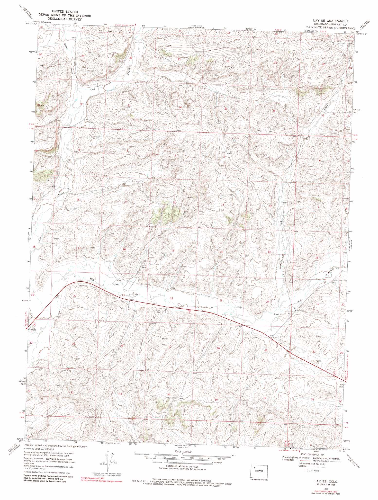
USGS Topo Quad 40107e7 - 1:24,000 scale
| Topo Map Name: | Lay Se |
| USGS Topo Quad ID: | 40107e7 |
| Print Size: | ca. 21 1/4" wide x 27" high |
| Southeast Coordinates: | 40.5° N latitude / 107.75° W longitude |
| Map Center Coordinates: | 40.5625° N latitude / 107.8125° W longitude |
| U.S. State: | CO |
| Filename: | o40107e7.jpg |
| Download Map JPG Image: | Lay Se topo map 1:24,000 scale |
| Map Type: | Topographic |
| Topo Series: | 7.5´ |
| Map Scale: | 1:24,000 |
| Source of Map Images: | United States Geological Survey (USGS) |
| Alternate Map Versions: |
Lay SE CO 1969, updated 1972 Download PDF Buy paper map Lay SE CO 1969, updated 1972 Download PDF Buy paper map Lay SE CO 1969, updated 1983 Download PDF Buy paper map Lay SE CO 1969, updated 1987 Download PDF Buy paper map Lay SE CO 2010 Download PDF Buy paper map Lay SE CO 2013 Download PDF Buy paper map Lay SE CO 2016 Download PDF Buy paper map |
1:24,000 Topo Quads surrounding Lay Se
The Nipple Se |
Mayberry Spring |
Great Divide |
East Timberlake Creek |
Fortification |
Bald Mountain |
Adobe Springs |
Iron Springs |
Craig Nw |
Craig Ne |
Maybell |
Lay |
Lay Se |
Pine Ridge |
Craig |
Juniper Mountain |
Juniper Hot Springs |
Horse Gulch |
Round Bottom |
Castor Gulch |
Price Creek |
Easton Gulch |
Axial |
Monument Butte |
Hamilton |
> Back to 40107e1 at 1:100,000 scale
> Back to 40106a1 at 1:250,000 scale
> Back to U.S. Topo Maps home
Lay Se topo map: Gazetteer
Lay Se: Mines
Airborne Anomaly 56-13 Mine elevation 1990m 6528′Airborne Anomaly 56-14 Mine elevation 1990m 6528′
Airborne Anomaly B17-102 Mine elevation 1923m 6309′
Emerson Mine elevation 2031m 6663′
Engle-Man-Bochman Mine elevation 1962m 6437′
Grassie Mine elevation 2021m 6630′
Hammontree Mine elevation 2031m 6663′
Harshberger Mine elevation 2031m 6663′
Lay Se: Valleys
Big Gulch elevation 1894m 6213′Bord Gulch elevation 1945m 6381′
North Fork Big Gulch elevation 1937m 6354′
Lay Se digital topo map on disk
Buy this Lay Se topo map showing relief, roads, GPS coordinates and other geographical features, as a high-resolution digital map file on DVD: