Lay Topo Map Colorado
To zoom in, hover over the map of Lay
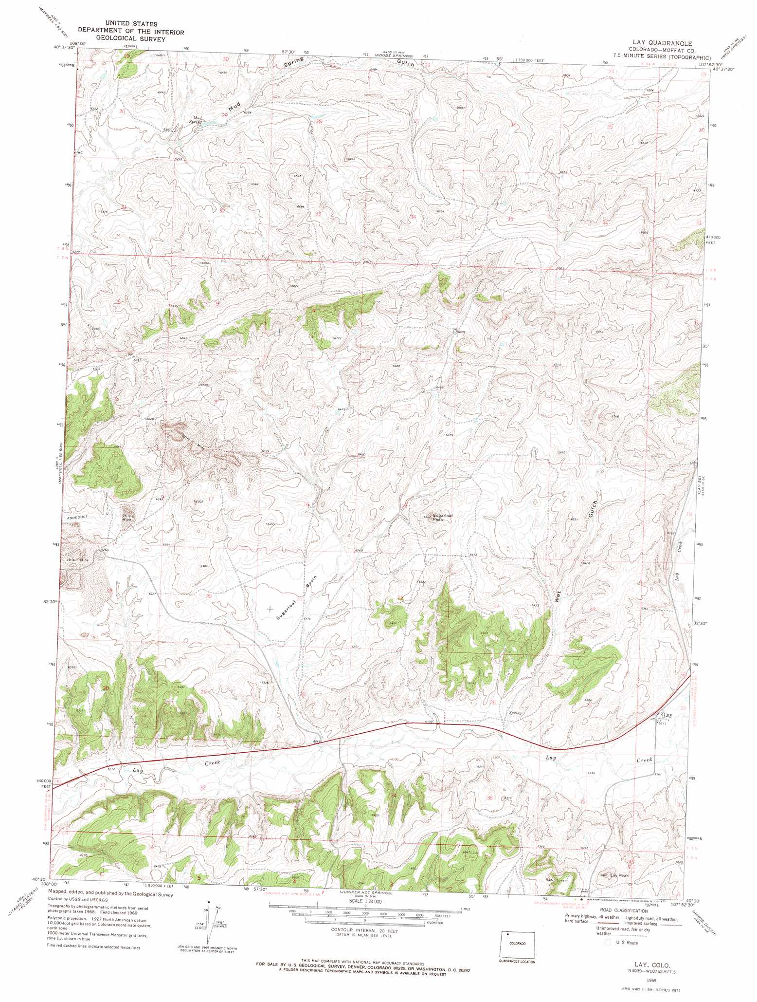
USGS Topo Quad 40107e8 - 1:24,000 scale
| Topo Map Name: | Lay |
| USGS Topo Quad ID: | 40107e8 |
| Print Size: | ca. 21 1/4" wide x 27" high |
| Southeast Coordinates: | 40.5° N latitude / 107.875° W longitude |
| Map Center Coordinates: | 40.5625° N latitude / 107.9375° W longitude |
| U.S. State: | CO |
| Filename: | o40107e8.jpg |
| Download Map JPG Image: | Lay topo map 1:24,000 scale |
| Map Type: | Topographic |
| Topo Series: | 7.5´ |
| Map Scale: | 1:24,000 |
| Source of Map Images: | United States Geological Survey (USGS) |
| Alternate Map Versions: |
Lay CO 1969, updated 1973 Download PDF Buy paper map Lay CO 2010 Download PDF Buy paper map Lay CO 2013 Download PDF Buy paper map Lay CO 2016 Download PDF Buy paper map |
1:24,000 Topo Quads surrounding Lay
The Nipple |
The Nipple Se |
Mayberry Spring |
Great Divide |
East Timberlake Creek |
Ninemile Hill |
Bald Mountain |
Adobe Springs |
Iron Springs |
Craig Nw |
Sunbeam |
Maybell |
Lay |
Lay Se |
Pine Ridge |
Cedar Knob |
Juniper Mountain |
Juniper Hot Springs |
Horse Gulch |
Round Bottom |
Citadel Plateau |
Price Creek |
Easton Gulch |
Axial |
Monument Butte |
> Back to 40107e1 at 1:100,000 scale
> Back to 40106a1 at 1:250,000 scale
> Back to U.S. Topo Maps home
Lay topo map: Gazetteer
Lay: Basins
Sugarloaf Basin elevation 1892m 6207′Lay: Mines
Agnes Number Seven Claim elevation 1925m 6315′Agnes Number Seven Mine elevation 1926m 6318′
Airborne Anomaly B17-101 Mine elevation 1949m 6394′
Buffalo Head Mining Company Claim Number Six elevation 1970m 6463′
Gertrude Mine elevation 1933m 6341′
Hazel Whetstone Property elevation 1861m 6105′
Hummingbird Claim elevation 1918m 6292′
Iron and Copper Claims elevation 1956m 6417′
Johnson M.C.S. Mine elevation 1903m 6243′
Johnson MCS Mine elevation 1903m 6243′
Marge Group Mine elevation 1928m 6325′
Sage-Buella Mine elevation 1928m 6325′
Shell Group Claim Number One elevation 1976m 6482′
Sugarloaf Mine elevation 1920m 6299′
Lay: Populated Places
Lay elevation 1884m 6181′Lay: Springs
Mud Spring elevation 1922m 6305′Lay: Summits
Lay Peak elevation 2027m 6650′Sugarloaf Peak elevation 2015m 6610′
Lay: Valleys
Wet Gulch elevation 1863m 6112′Lay digital topo map on disk
Buy this Lay topo map showing relief, roads, GPS coordinates and other geographical features, as a high-resolution digital map file on DVD: