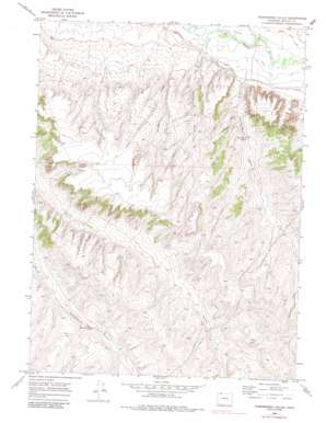
Thornburgh Gulch Topo Map Colorado
To zoom in, hover over the map of Thornburgh Gulch
USGS Topo Quad 40107h7 - 1:24,000 scale
| Topo Map Name: | Thornburgh Gulch |
| USGS Topo Quad ID: | 40107h7 |
| Print Size: | ca. 21 1/4" wide x 27" high |
| Southeast Coordinates: | 40.875° N latitude / 107.75° W longitude |
| Map Center Coordinates: | 40.9375° N latitude / 107.8125° W longitude |
| U.S. State: | CO |
| Filename: | o40107h7.jpg |
| Download Map JPG Image: | Thornburgh Gulch topo map 1:24,000 scale |
| Map Type: | Topographic |
| Topo Series: | 7.5´ |
| Map Scale: | 1:24,000 |
| Source of Map Images: | United States Geological Survey (USGS) |
| Alternate Map Versions: |
Thornburgh Gulch CO 1969, updated 1972 Download PDF Buy paper map Thornburgh Gulch CO 1969, updated 1972 Download PDF Buy paper map Thornburgh Gulch CO 1969, updated 1985 Download PDF Buy paper map Thornburgh Gulch CO 2010 Download PDF Buy paper map Thornburgh Gulch CO 2013 Download PDF Buy paper map Thornburgh Gulch CO 2016 Download PDF Buy paper map |
1:24,000 Topo Quads surrounding Thornburgh Gulch
> Back to 40107e1 at 1:100,000 scale
> Back to 40106a1 at 1:250,000 scale
> Back to U.S. Topo Maps home
Thornburgh Gulch topo map: Gazetteer
Thornburgh Gulch: Canals
Gibson Blair Ditch elevation 1887m 6190′Trowel Ditch elevation 1878m 6161′
Thornburgh Gulch: Mines
Dry Gulch Mine elevation 1945m 6381′Thornburgh Gulch: Springs
Conway Spring elevation 2014m 6607′Monasco Spring elevation 1976m 6482′
Thornburgh Spring elevation 1921m 6302′
Thornburgh Gulch: Valleys
Thornburgh Gulch elevation 1885m 6184′Tommys Gulch elevation 1887m 6190′
Woodbury Gulch elevation 1893m 6210′
Thornburgh Gulch digital topo map on disk
Buy this Thornburgh Gulch topo map showing relief, roads, GPS coordinates and other geographical features, as a high-resolution digital map file on DVD:


