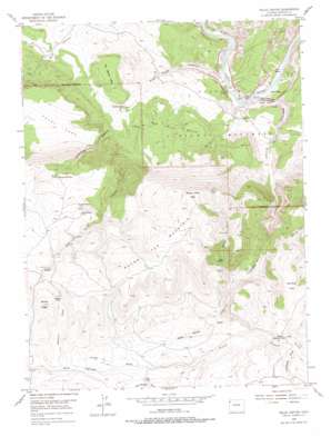
Hells Canyon Topo Map Colorado
To zoom in, hover over the map of Hells Canyon
USGS Topo Quad 40108d8 - 1:24,000 scale
| Topo Map Name: | Hells Canyon |
| USGS Topo Quad ID: | 40108d8 |
| Print Size: | ca. 21 1/4" wide x 27" high |
| Southeast Coordinates: | 40.375° N latitude / 108.875° W longitude |
| Map Center Coordinates: | 40.4375° N latitude / 108.9375° W longitude |
| U.S. State: | CO |
| Filename: | o40108d8.jpg |
| Download Map JPG Image: | Hells Canyon topo map 1:24,000 scale |
| Map Type: | Topographic |
| Topo Series: | 7.5´ |
| Map Scale: | 1:24,000 |
| Source of Map Images: | United States Geological Survey (USGS) |
| Alternate Map Versions: |
Hells Canyon CO 1954, updated 1955 Download PDF Buy paper map Hells Canyon CO 1954, updated 1955 Download PDF Buy paper map Hells Canyon CO 1954, updated 1968 Download PDF Buy paper map Hells Canyon CO 1954, updated 1968 Download PDF Buy paper map Hells Canyon CO 1954, updated 1978 Download PDF Buy paper map Hells Canyon CO 2010 Download PDF Buy paper map Hells Canyon CO 2013 Download PDF Buy paper map Hells Canyon CO 2016 Download PDF Buy paper map |
1:24,000 Topo Quads surrounding Hells Canyon
> Back to 40108a1 at 1:100,000 scale
> Back to 40108a1 at 1:250,000 scale
> Back to U.S. Topo Maps home
Hells Canyon topo map: Gazetteer
Hells Canyon: Benches
The Billard Table elevation 1798m 5898′Hells Canyon: Cliffs
Crows Nest elevation 1592m 5223′Katys Nipple elevation 1636m 5367′
Hells Canyon: Flats
Burro Park elevation 1681m 5515′Castle Park elevation 1580m 5183′
Laddie Park elevation 1566m 5137′
Pearl Park elevation 1981m 6499′
Hells Canyon: Pillars
Castle Rock elevation 1673m 5488′Hells Canyon: Populated Places
Robinson Place elevation 2377m 7798′Hells Canyon: Reservoirs
Red Rock Reservoir elevation 2371m 7778′Hells Canyon: Springs
Bobcat Springs elevation 2194m 7198′Mud Spring elevation 2265m 7431′
Surveyor Spring elevation 2307m 7568′
Hells Canyon: Streams
Burdett Creek elevation 2167m 7109′Cottonwood Creek elevation 1564m 5131′
The Slough elevation 2138m 7014′
Turners Creek elevation 1566m 5137′
Hells Canyon: Summits
Buena Vista Peak elevation 2613m 8572′Hospital Hill elevation 1598m 5242′
Red Rock Bench elevation 1891m 6204′
Round Top Mountain elevation 2614m 8576′
Hells Canyon: Valleys
Antelope Draw elevation 2167m 7109′Bobcat Draw elevation 2073m 6801′
Cottonwood Canyon elevation 1734m 5688′
Hells Canyon elevation 1573m 5160′
Juniper Canyon elevation 2033m 6669′
Marthas Draw elevation 2087m 6847′
Mud Springs Draw elevation 2175m 7135′
Red Rock Canyon elevation 1569m 5147′
Robinson Draw elevation 2311m 7582′
Spike Hollow Draw elevation 2122m 6961′
Hells Canyon digital topo map on disk
Buy this Hells Canyon topo map showing relief, roads, GPS coordinates and other geographical features, as a high-resolution digital map file on DVD:


