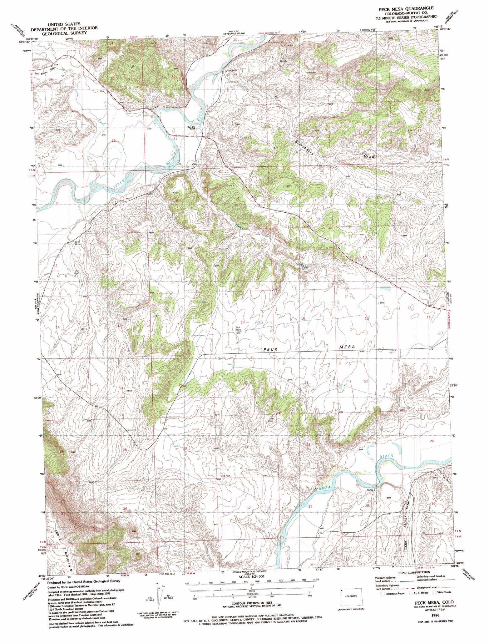
Peck Mesa Topo Map Colorado
To zoom in, hover over the map of Peck Mesa
USGS Topo Quad 40108e3 - 1:24,000 scale
| Topo Map Name: | Peck Mesa |
| USGS Topo Quad ID: | 40108e3 |
| Print Size: | ca. 21 1/4" wide x 27" high |
| Southeast Coordinates: | 40.5° N latitude / 108.25° W longitude |
| Map Center Coordinates: | 40.5625° N latitude / 108.3125° W longitude |
| U.S. State: | CO |
| Filename: | o40108e3.jpg |
| Download Map JPG Image: | Peck Mesa topo map 1:24,000 scale |
| Map Type: | Topographic |
| Topo Series: | 7.5´ |
| Map Scale: | 1:24,000 |
| Source of Map Images: | United States Geological Survey (USGS) |
| Alternate Map Versions: |
Peck Mesa CO 1986, updated 1986 Download PDF Buy paper map Peck Mesa CO 2010 Download PDF Buy paper map Peck Mesa CO 2013 Download PDF Buy paper map Peck Mesa CO 2016 Download PDF Buy paper map |
1:24,000 Topo Quads surrounding Peck Mesa
G Spring |
Sheepherder Springs |
Lang Spring |
The Nipple |
The Nipple Se |
Sheephead Basin |
Clay Buttes |
Sevenmile Draw |
Ninemile Hill |
Bald Mountain |
Limestone Hill |
Lone Mountain |
Peck Mesa |
Sunbeam |
Maybell |
Indian Water Canyon |
Twelvemile Mesa |
Cross Mountain Canyon |
Cedar Knob |
Juniper Mountain |
M F Mountain |
Elk Springs |
Wapiti Peak |
Citadel Plateau |
Price Creek |
> Back to 40108e1 at 1:100,000 scale
> Back to 40108a1 at 1:250,000 scale
> Back to U.S. Topo Maps home
Peck Mesa topo map: Gazetteer
Peck Mesa: Summits
Peck Mesa elevation 1941m 6368′Peck Mesa: Valleys
Cedar Springs Draw elevation 1791m 5875′East Boone Draw elevation 1768m 5800′
Lone Tree Gulch elevation 1786m 5859′
Sand Wash elevation 1751m 5744′
Simsberry Draw elevation 1768m 5800′
Three C Wash elevation 1750m 5741′
Peck Mesa digital topo map on disk
Buy this Peck Mesa topo map showing relief, roads, GPS coordinates and other geographical features, as a high-resolution digital map file on DVD: