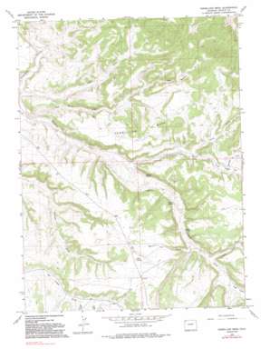
Vermillion Mesa Topo Map Colorado
To zoom in, hover over the map of Vermillion Mesa
USGS Topo Quad 40108f6 - 1:24,000 scale
| Topo Map Name: | Vermillion Mesa |
| USGS Topo Quad ID: | 40108f6 |
| Print Size: | ca. 21 1/4" wide x 27" high |
| Southeast Coordinates: | 40.625° N latitude / 108.625° W longitude |
| Map Center Coordinates: | 40.6875° N latitude / 108.6875° W longitude |
| U.S. State: | CO |
| Filename: | o40108f6.jpg |
| Download Map JPG Image: | Vermillion Mesa topo map 1:24,000 scale |
| Map Type: | Topographic |
| Topo Series: | 7.5´ |
| Map Scale: | 1:24,000 |
| Source of Map Images: | United States Geological Survey (USGS) |
| Alternate Map Versions: |
Vermillion Mesa CO 1966, updated 1970 Download PDF Buy paper map Vermillion Mesa CO 1966, updated 1970 Download PDF Buy paper map Vermillion Mesa CO 1966, updated 1981 Download PDF Buy paper map Vermillion Mesa CO 1966, updated 1992 Download PDF Buy paper map Vermillion Mesa CO 2010 Download PDF Buy paper map Vermillion Mesa CO 2013 Download PDF Buy paper map Vermillion Mesa CO 2016 Download PDF Buy paper map |
1:24,000 Topo Quads surrounding Vermillion Mesa
> Back to 40108e1 at 1:100,000 scale
> Back to 40108a1 at 1:250,000 scale
> Back to U.S. Topo Maps home
Vermillion Mesa topo map: Gazetteer
Vermillion Mesa: Flats
Hughes Flat elevation 1894m 6213′Vermillion Mesa: Springs
Hughes Spring elevation 1811m 5941′Loomis Spring elevation 1843m 6046′
Willow Spring elevation 1830m 6003′
Vermillion Mesa: Streams
Talamantes Creek elevation 1967m 6453′Vermillion Mesa: Summits
Dry Knob elevation 1972m 6469′Vermillion Mesa elevation 1971m 6466′
Vermillion Mesa: Valleys
Big Bend Draw elevation 1732m 5682′Hartman Draw elevation 1894m 6213′
Kraft Draw elevation 1856m 6089′
Kurth Draw elevation 1907m 6256′
Langley Draw elevation 1869m 6131′
Lefthand Draw elevation 1917m 6289′
Martin Draw elevation 1854m 6082′
Sager Draw elevation 1880m 6167′
Teds Draw elevation 1730m 5675′
Thomas Draw elevation 1903m 6243′
West Boone Draw elevation 1795m 5889′
Vermillion Mesa digital topo map on disk
Buy this Vermillion Mesa topo map showing relief, roads, GPS coordinates and other geographical features, as a high-resolution digital map file on DVD:


