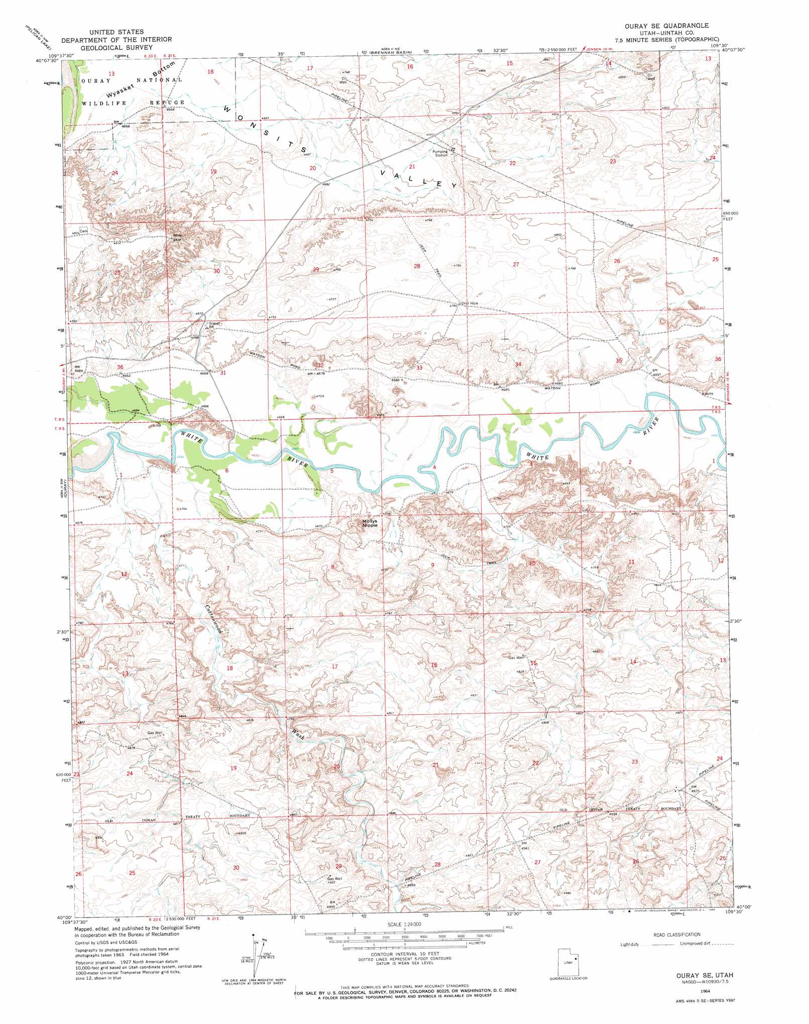
Ouray Se Topo Map Utah
To zoom in, hover over the map of Ouray Se
USGS Topo Quad 40109a5 - 1:24,000 scale
| Topo Map Name: | Ouray Se |
| USGS Topo Quad ID: | 40109a5 |
| Print Size: | ca. 21 1/4" wide x 27" high |
| Southeast Coordinates: | 40° N latitude / 109.5° W longitude |
| Map Center Coordinates: | 40.0625° N latitude / 109.5625° W longitude |
| U.S. State: | UT |
| Filename: | o40109a5.jpg |
| Download Map JPG Image: | Ouray Se topo map 1:24,000 scale |
| Map Type: | Topographic |
| Topo Series: | 7.5´ |
| Map Scale: | 1:24,000 |
| Source of Map Images: | United States Geological Survey (USGS) |
| Alternate Map Versions: |
Ouray SE UT 1964, updated 1966 Download PDF Buy paper map Ouray SE UT 2011 Download PDF Buy paper map Ouray SE UT 2014 Download PDF Buy paper map |
1:24,000 Topo Quads surrounding Ouray Se
Fort Duchesne |
Vernal Sw |
Vernal Se |
Rasmussen Hollow |
Jensen |
Randlett |
Pelican Lake |
Brennan Basin |
Red Wash Nw |
Red Wash |
Uteland Butte |
Ouray |
Ouray Se |
Red Wash Sw |
Red Wash Se |
Moon Bottom |
Big Pack Mountain Nw |
Big Pack Mountain Ne |
Archy Bench |
Asphalt Wash |
Nutters Hole |
Big Pack Mountain |
Big Pack Mountain Se |
Buck Camp Canyon |
Archy Bench Se |
> Back to 40109a1 at 1:100,000 scale
> Back to 40108a1 at 1:250,000 scale
> Back to U.S. Topo Maps home
Ouray Se topo map: Gazetteer
Ouray Se: Summits
Mollys Nipple elevation 1483m 4865′Ouray Se: Valleys
Antelope Draw elevation 1432m 4698′Cottonwood Wash elevation 1423m 4668′
Ouray Se digital topo map on disk
Buy this Ouray Se topo map showing relief, roads, GPS coordinates and other geographical features, as a high-resolution digital map file on DVD: