Ouray Topo Map Utah
To zoom in, hover over the map of Ouray
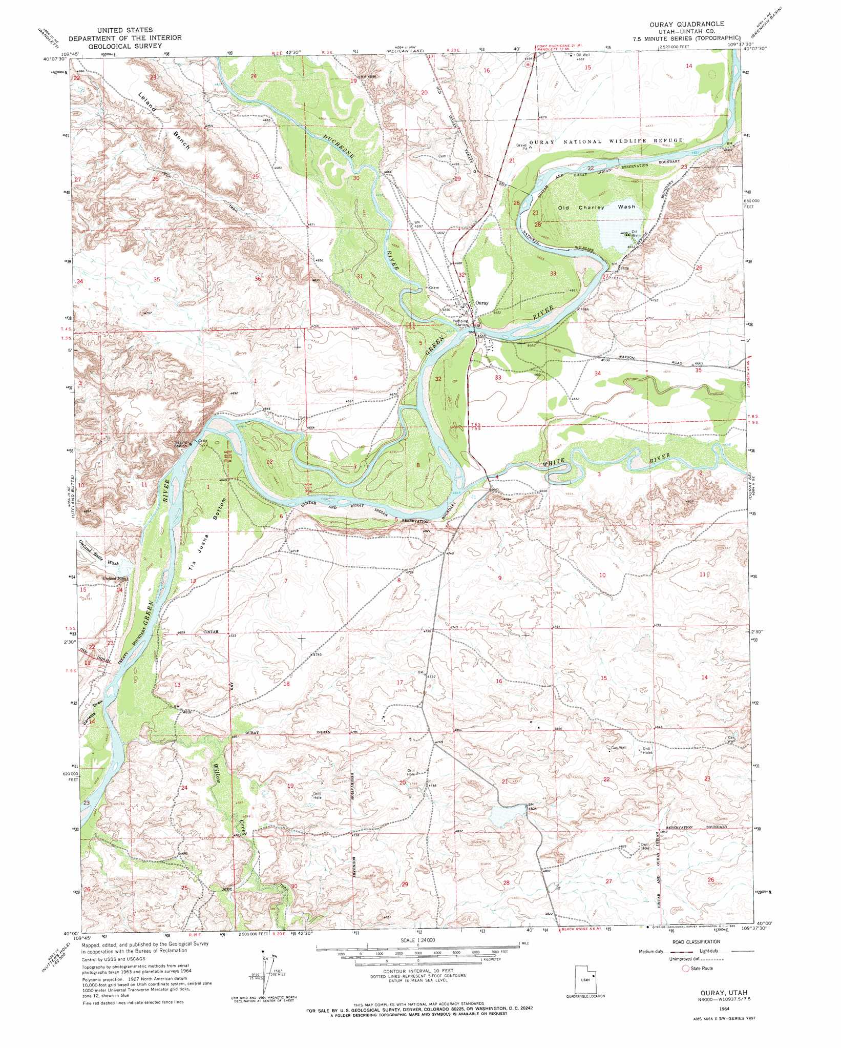
USGS Topo Quad 40109a6 - 1:24,000 scale
| Topo Map Name: | Ouray |
| USGS Topo Quad ID: | 40109a6 |
| Print Size: | ca. 21 1/4" wide x 27" high |
| Southeast Coordinates: | 40° N latitude / 109.625° W longitude |
| Map Center Coordinates: | 40.0625° N latitude / 109.6875° W longitude |
| U.S. State: | UT |
| Filename: | o40109a6.jpg |
| Download Map JPG Image: | Ouray topo map 1:24,000 scale |
| Map Type: | Topographic |
| Topo Series: | 7.5´ |
| Map Scale: | 1:24,000 |
| Source of Map Images: | United States Geological Survey (USGS) |
| Alternate Map Versions: |
Ouray UT 1964, updated 1966 Download PDF Buy paper map Ouray UT 1964, updated 1966 Download PDF Buy paper map Ouray UT 2011 Download PDF Buy paper map Ouray UT 2014 Download PDF Buy paper map |
1:24,000 Topo Quads surrounding Ouray
Roosevelt |
Fort Duchesne |
Vernal Sw |
Vernal Se |
Rasmussen Hollow |
Windy Ridge |
Randlett |
Pelican Lake |
Brennan Basin |
Red Wash Nw |
Pariette Draw Sw |
Uteland Butte |
Ouray |
Ouray Se |
Red Wash Sw |
Crow Knoll |
Moon Bottom |
Big Pack Mountain Nw |
Big Pack Mountain Ne |
Archy Bench |
Duches Hole |
Nutters Hole |
Big Pack Mountain |
Big Pack Mountain Se |
Buck Camp Canyon |
> Back to 40109a1 at 1:100,000 scale
> Back to 40108a1 at 1:250,000 scale
> Back to U.S. Topo Maps home
Ouray topo map: Gazetteer
Ouray: Bends
Old Charley Wash elevation 1420m 4658′Tia Juana Bottom elevation 1418m 4652′
Ouray: Mines
Uteland Mine elevation 1425m 4675′Ouray: Populated Places
Ouray elevation 1425m 4675′Ouray: Streams
Duchesne River elevation 1418m 4652′White River elevation 1416m 4645′
Willow Creek elevation 1415m 4642′
Ouray: Valleys
Pariette Draw elevation 1414m 4639′Uinta Valley elevation 1418m 4652′
Uteland Butte Wash elevation 1416m 4645′
Ouray digital topo map on disk
Buy this Ouray topo map showing relief, roads, GPS coordinates and other geographical features, as a high-resolution digital map file on DVD: