Roosevelt Topo Map Utah
To zoom in, hover over the map of Roosevelt
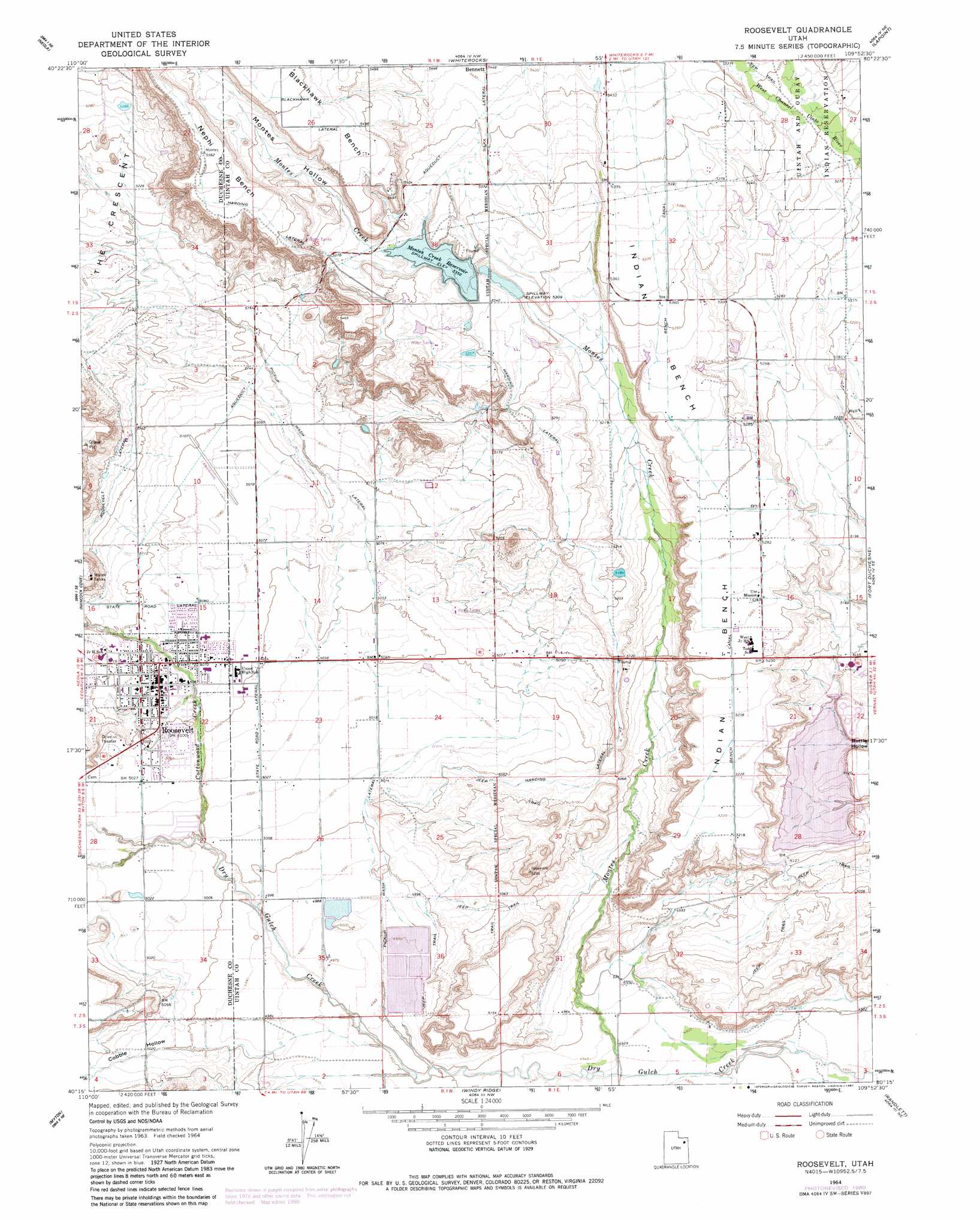
USGS Topo Quad 40109c8 - 1:24,000 scale
| Topo Map Name: | Roosevelt |
| USGS Topo Quad ID: | 40109c8 |
| Print Size: | ca. 21 1/4" wide x 27" high |
| Southeast Coordinates: | 40.25° N latitude / 109.875° W longitude |
| Map Center Coordinates: | 40.3125° N latitude / 109.9375° W longitude |
| U.S. State: | UT |
| Filename: | o40109c8.jpg |
| Download Map JPG Image: | Roosevelt topo map 1:24,000 scale |
| Map Type: | Topographic |
| Topo Series: | 7.5´ |
| Map Scale: | 1:24,000 |
| Source of Map Images: | United States Geological Survey (USGS) |
| Alternate Map Versions: |
Roosevelt UT 1964, updated 1966 Download PDF Buy paper map Roosevelt UT 1964, updated 1981 Download PDF Buy paper map Roosevelt UT 2011 Download PDF Buy paper map Roosevelt UT 2014 Download PDF Buy paper map |
1:24,000 Topo Quads surrounding Roosevelt
Heller Lake |
Pole Creek Cave |
Ice Cave Peak |
Lake Mountain |
Dry Fork |
Neola Nw |
Neola |
Whiterocks |
Lapoint |
Vernal Nw |
Bluebell |
Hancock Cove |
Roosevelt |
Fort Duchesne |
Vernal Sw |
Bridgeland |
Myton |
Windy Ridge |
Randlett |
Pelican Lake |
Myton Sw |
Myton Se |
Pariette Draw Sw |
Uteland Butte |
Ouray |
> Back to 40109a1 at 1:100,000 scale
> Back to 40108a1 at 1:250,000 scale
> Back to U.S. Topo Maps home
Roosevelt topo map: Gazetteer
Roosevelt: Benches
Indian Bench elevation 1616m 5301′Roosevelt: Canals
Bench Canal elevation 1644m 5393′Blackhawk Lateral elevation 1690m 5544′
Harding Lateral elevation 1625m 5331′
Pickup Wash Lateral elevation 1534m 5032′
State Road Lateral elevation 1545m 5068′
State Road Lateral elevation 1535m 5036′
Roosevelt: Dams
Lynn Haslem Dam elevation 1625m 5331′Montes Creek Dam elevation 1629m 5344′
Roosevelt: Populated Places
Ballard elevation 1539m 5049′Bennett elevation 1660m 5446′
Roosevelt elevation 1553m 5095′
Roosevelt: Post Offices
Roosevelt Post Office elevation 1549m 5082′Roosevelt: Reservoirs
Lynn Haslem Reservoir elevation 1625m 5331′Montes Creek Reservoir elevation 1633m 5357′
Montes Creek Reservoir elevation 1629m 5344′
Roosevelt: Streams
Cottonwood Creek elevation 1519m 4983′Montes Creek elevation 1500m 4921′
Roosevelt: Valleys
Cobble Hollow elevation 1506m 4940′Montes Hollow elevation 1635m 5364′
Roosevelt digital topo map on disk
Buy this Roosevelt topo map showing relief, roads, GPS coordinates and other geographical features, as a high-resolution digital map file on DVD: