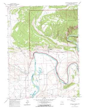
Dinosaur Quarry Topo Map Utah
To zoom in, hover over the map of Dinosaur Quarry
USGS Topo Quad 40109d3 - 1:24,000 scale
| Topo Map Name: | Dinosaur Quarry |
| USGS Topo Quad ID: | 40109d3 |
| Print Size: | ca. 21 1/4" wide x 27" high |
| Southeast Coordinates: | 40.375° N latitude / 109.25° W longitude |
| Map Center Coordinates: | 40.4375° N latitude / 109.3125° W longitude |
| U.S. State: | UT |
| Filename: | o40109d3.jpg |
| Download Map JPG Image: | Dinosaur Quarry topo map 1:24,000 scale |
| Map Type: | Topographic |
| Topo Series: | 7.5´ |
| Map Scale: | 1:24,000 |
| Source of Map Images: | United States Geological Survey (USGS) |
| Alternate Map Versions: |
Dinosaur Quarry UT 1965, updated 1967 Download PDF Buy paper map Dinosaur Quarry UT 1965, updated 1967 Download PDF Buy paper map Dinosaur Quarry UT 2011 Download PDF Buy paper map Dinosaur Quarry UT 2014 Download PDF Buy paper map |
1:24,000 Topo Quads surrounding Dinosaur Quarry
> Back to 40109a1 at 1:100,000 scale
> Back to 40108a1 at 1:250,000 scale
> Back to U.S. Topo Maps home
Dinosaur Quarry topo map: Gazetteer
Dinosaur Quarry: Crossings
Escalante Crossing elevation 1443m 4734′Dinosaur Quarry: Streams
Brush Creek elevation 1444m 4737′Cliff Creek elevation 1442m 4730′
Dinosaur Quarry: Trails
Red Rock Nature Trail elevation 1555m 5101′Dinosaur Quarry: Valleys
Bean Draw elevation 1509m 4950′Cottonwood Wash elevation 1462m 4796′
Orchid Draw elevation 1452m 4763′
Red Wash elevation 1451m 4760′
Split Mountain Canyon elevation 1462m 4796′
Dinosaur Quarry digital topo map on disk
Buy this Dinosaur Quarry topo map showing relief, roads, GPS coordinates and other geographical features, as a high-resolution digital map file on DVD:


