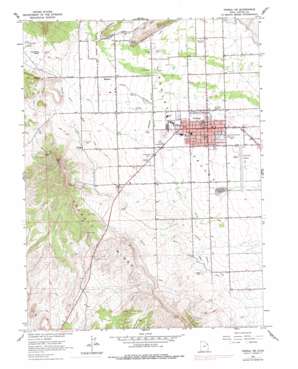
Vernal Ne Topo Map Utah
To zoom in, hover over the map of Vernal Ne
USGS Topo Quad 40109d5 - 1:24,000 scale
| Topo Map Name: | Vernal Ne |
| USGS Topo Quad ID: | 40109d5 |
| Print Size: | ca. 21 1/4" wide x 27" high |
| Southeast Coordinates: | 40.375° N latitude / 109.5° W longitude |
| Map Center Coordinates: | 40.4375° N latitude / 109.5625° W longitude |
| U.S. State: | UT |
| Filename: | o40109d5.jpg |
| Download Map JPG Image: | Vernal Ne topo map 1:24,000 scale |
| Map Type: | Topographic |
| Topo Series: | 7.5´ |
| Map Scale: | 1:24,000 |
| Source of Map Images: | United States Geological Survey (USGS) |
| Alternate Map Versions: |
Vernal NE UT 1964, updated 1965 Download PDF Buy paper map Vernal NE UT 1964, updated 1979 Download PDF Buy paper map Vernal NE UT 2011 Download PDF Buy paper map Vernal NE UT 2014 Download PDF Buy paper map |
1:24,000 Topo Quads surrounding Vernal Ne
> Back to 40109a1 at 1:100,000 scale
> Back to 40108a1 at 1:250,000 scale
> Back to U.S. Topo Maps home
Vernal Ne topo map: Gazetteer
Vernal Ne: Airports
Air Village Strip elevation 1764m 5787′Ashley Valley Hospital Heliport elevation 1628m 5341′
Vernal Airport elevation 1600m 5249′
Vernal Ne: Basins
Coal Mine Basin elevation 1783m 5849′Vernal Ne: Canals
Ashley Central Canal elevation 1653m 5423′Ashley Upper Canal elevation 1722m 5649′
Highline Canal elevation 1732m 5682′
Steinaker Feeder Canal elevation 1708m 5603′
Steinaker Service Canal elevation 1660m 5446′
Vernal Ne: Cliffs
Rock Point elevation 1691m 5547′Vernal Ne: Parks
Utah Field House of Natural History elevation 1619m 5311′Vernal Ne: Populated Places
Maeser elevation 1707m 5600′Vernal elevation 1624m 5328′
Vernal Ne: Post Offices
Vernal Post Office elevation 1626m 5334′Vernal Ne: Ridges
Asphalt Ridge elevation 1881m 6171′Vernal Ne digital topo map on disk
Buy this Vernal Ne topo map showing relief, roads, GPS coordinates and other geographical features, as a high-resolution digital map file on DVD:


