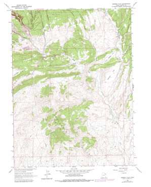
Donkey Flat Topo Map Utah
To zoom in, hover over the map of Donkey Flat
USGS Topo Quad 40109e4 - 1:24,000 scale
| Topo Map Name: | Donkey Flat |
| USGS Topo Quad ID: | 40109e4 |
| Print Size: | ca. 21 1/4" wide x 27" high |
| Southeast Coordinates: | 40.5° N latitude / 109.375° W longitude |
| Map Center Coordinates: | 40.5625° N latitude / 109.4375° W longitude |
| U.S. State: | UT |
| Filename: | o40109e4.jpg |
| Download Map JPG Image: | Donkey Flat topo map 1:24,000 scale |
| Map Type: | Topographic |
| Topo Series: | 7.5´ |
| Map Scale: | 1:24,000 |
| Source of Map Images: | United States Geological Survey (USGS) |
| Alternate Map Versions: |
Donkey Flat UT 1965, updated 1967 Download PDF Buy paper map Donkey Flat UT 1965, updated 1979 Download PDF Buy paper map Donkey Flat UT 2011 Download PDF Buy paper map Donkey Flat UT 2014 Download PDF Buy paper map |
1:24,000 Topo Quads surrounding Donkey Flat
> Back to 40109e1 at 1:100,000 scale
> Back to 40108a1 at 1:250,000 scale
> Back to U.S. Topo Maps home
Donkey Flat topo map: Gazetteer
Donkey Flat: Dams
Stauffer Chemical Tailings Pond North Dam elevation 1775m 5823′Donkey Flat: Flats
Donkey Flat elevation 1739m 5705′Little Donkey Flat elevation 1769m 5803′
Donkey Flat: Reservoirs
Red Fleet Reservoir elevation 1730m 5675′Stauffer Chemical Tailings Pond North elevation 1775m 5823′
Donkey Flat: Streams
Big Brush Creek elevation 1645m 5396′Cottonwood Wash elevation 1666m 5465′
Little Brush Creek elevation 1644m 5393′
Donkey Flat: Summits
Buckskin Hills elevation 1695m 5561′Donkey Flat: Valleys
Big Brush Gorge elevation 1780m 5839′Buckhorn Canyon elevation 1720m 5643′
Camp Canyon elevation 1744m 5721′
Chicken Coop Draw elevation 1745m 5725′
Constantine Canyon elevation 1785m 5856′
Cottonwood Canyon elevation 1893m 6210′
East Cottonwood Canyon elevation 1754m 5754′
Hole in the Wall Canyon elevation 1762m 5780′
Independence Canyon elevation 1812m 5944′
Jackpot Canyon elevation 1798m 5898′
Pothole Canyon elevation 1782m 5846′
Donkey Flat digital topo map on disk
Buy this Donkey Flat topo map showing relief, roads, GPS coordinates and other geographical features, as a high-resolution digital map file on DVD:


