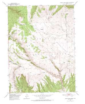
Burnt Cabin Gorge Topo Map Utah
To zoom in, hover over the map of Burnt Cabin Gorge
USGS Topo Quad 40109f4 - 1:24,000 scale
| Topo Map Name: | Burnt Cabin Gorge |
| USGS Topo Quad ID: | 40109f4 |
| Print Size: | ca. 21 1/4" wide x 27" high |
| Southeast Coordinates: | 40.625° N latitude / 109.375° W longitude |
| Map Center Coordinates: | 40.6875° N latitude / 109.4375° W longitude |
| U.S. State: | UT |
| Filename: | o40109f4.jpg |
| Download Map JPG Image: | Burnt Cabin Gorge topo map 1:24,000 scale |
| Map Type: | Topographic |
| Topo Series: | 7.5´ |
| Map Scale: | 1:24,000 |
| Source of Map Images: | United States Geological Survey (USGS) |
| Alternate Map Versions: |
Burnt Cabin Gorge UT 1950, updated 1952 Download PDF Buy paper map Burnt Cabin Gorge UT 1950, updated 1973 Download PDF Buy paper map Burnt Cabin Gorge UT 1996, updated 1999 Download PDF Buy paper map Burnt Cabin Gorge UT 2011 Download PDF Buy paper map Burnt Cabin Gorge UT 2014 Download PDF Buy paper map |
| FStopo: | US Forest Service topo Burnt Cabin Gorge is available: Download FStopo PDF Download FStopo TIF |
1:24,000 Topo Quads surrounding Burnt Cabin Gorge
> Back to 40109e1 at 1:100,000 scale
> Back to 40108a1 at 1:250,000 scale
> Back to U.S. Topo Maps home
Burnt Cabin Gorge topo map: Gazetteer
Burnt Cabin Gorge: Areas
Drive Through the Ages Geological Area elevation 2394m 7854′Burnt Cabin Gorge: Reservoirs
Association Reservoir elevation 2383m 7818′Counting Station Reservoir elevation 2460m 8070′
Burnt Cabin Gorge: Springs
Aspen Spring elevation 2389m 7837′Aspen Spring elevation 2346m 7696′
Barker Spring elevation 2390m 7841′
Bassett Spring elevation 2550m 8366′
Boundary Spring elevation 2387m 7831′
Buckboard Spring elevation 2458m 8064′
Bull Spring elevation 2386m 7828′
Chicken Spring elevation 2336m 7664′
Freestone Spring elevation 2441m 8008′
Gorge Spring elevation 2341m 7680′
Limestone Spring elevation 2583m 8474′
Marvin Spring elevation 2346m 7696′
McKee Spring elevation 2411m 7910′
Point Spring elevation 2251m 7385′
Burnt Cabin Gorge: Streams
Bassett Creek elevation 2311m 7582′Limestone Creek elevation 2373m 7785′
Pothole Creek elevation 2422m 7946′
Reader Creek elevation 2311m 7582′
The Seeps elevation 2028m 6653′
Burnt Cabin Gorge: Summits
Limestone Mountain elevation 2826m 9271′Little Brush Creek Knob elevation 2636m 8648′
Burnt Cabin Gorge: Valleys
Burnt Canyon elevation 1932m 6338′Dutch Charles Draw elevation 2325m 7627′
East Draw elevation 2476m 8123′
Grizzly Hollow elevation 2471m 8106′
Indian Hollow elevation 2060m 6758′
Kabell Hollow elevation 2384m 7821′
Kane Hollow elevation 2469m 8100′
Mary Cashem Canyon elevation 1891m 6204′
The Gorge elevation 1924m 6312′
Burnt Cabin Gorge digital topo map on disk
Buy this Burnt Cabin Gorge topo map showing relief, roads, GPS coordinates and other geographical features, as a high-resolution digital map file on DVD:


