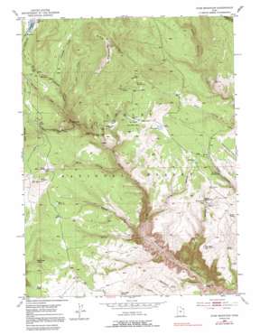
Dyer Mountain Topo Map Utah
To zoom in, hover over the map of Dyer Mountain
USGS Topo Quad 40109f5 - 1:24,000 scale
| Topo Map Name: | Dyer Mountain |
| USGS Topo Quad ID: | 40109f5 |
| Print Size: | ca. 21 1/4" wide x 27" high |
| Southeast Coordinates: | 40.625° N latitude / 109.5° W longitude |
| Map Center Coordinates: | 40.6875° N latitude / 109.5625° W longitude |
| U.S. State: | UT |
| Filename: | o40109f5.jpg |
| Download Map JPG Image: | Dyer Mountain topo map 1:24,000 scale |
| Map Type: | Topographic |
| Topo Series: | 7.5´ |
| Map Scale: | 1:24,000 |
| Source of Map Images: | United States Geological Survey (USGS) |
| Alternate Map Versions: |
Dyer Mountain UT 1950, updated 1952 Download PDF Buy paper map Dyer Mountain UT 1950, updated 1970 Download PDF Buy paper map Dyer Mountain UT 1950, updated 1991 Download PDF Buy paper map Dyer Mountain UT 1996, updated 2000 Download PDF Buy paper map Dyer Mountain UT 2011 Download PDF Buy paper map Dyer Mountain UT 2014 Download PDF Buy paper map |
| FStopo: | US Forest Service topo Dyer Mountain is available: Download FStopo PDF Download FStopo TIF |
1:24,000 Topo Quads surrounding Dyer Mountain
> Back to 40109e1 at 1:100,000 scale
> Back to 40108a1 at 1:250,000 scale
> Back to U.S. Topo Maps home
Dyer Mountain topo map: Gazetteer
Dyer Mountain: Areas
Twin Parks elevation 2754m 9035′Dyer Mountain: Bridges
Brush Creek Bridge elevation 2580m 8464′Dyer Mountain: Dams
Oaks Park Dam elevation 2824m 9265′Dyer Mountain: Lakes
Big Lake elevation 2656m 8713′Little Lake elevation 2595m 8513′
Dyer Mountain: Mines
Dyer Mines elevation 3003m 9852′Dyer Mountain: Plains
Taylor Mountain Plateau elevation 2675m 8776′Dyer Mountain: Populated Places
Bullionville elevation 2595m 8513′Dyer Mountain: Reservoirs
Oaks Park Reservoir elevation 2829m 9281′Dyer Mountain: Springs
Bear Spring elevation 2577m 8454′Brush Creek Spring elevation 1865m 6118′
Bullionville Spring elevation 2588m 8490′
Colton Spring elevation 2485m 8152′
Davis Spring elevation 2680m 8792′
Dodds Hollow Spring elevation 2558m 8392′
Gartell Spring elevation 2493m 8179′
Gibson Spring elevation 2554m 8379′
Henline Spring elevation 2465m 8087′
Iron Spring elevation 2650m 8694′
Kabell Spring elevation 2519m 8264′
Mud Spring elevation 2596m 8517′
Murray Park Spring elevation 2606m 8549′
Paradise Spring elevation 2452m 8044′
Parson City Spring elevation 2733m 8966′
Point Spring elevation 2318m 7604′
Roaring Fork Spring elevation 2586m 8484′
Shelmadine Spring elevation 2496m 8188′
Three Trough Spring elevation 2558m 8392′
Trout Spring elevation 2347m 7700′
Dyer Mountain: Streams
Anderson Creek elevation 2695m 8841′Government Creek elevation 2608m 8556′
Loco Creek elevation 2654m 8707′
Roaring Fork elevation 2162m 7093′
Dyer Mountain: Summits
Dyer Mountain elevation 3116m 10223′Dyer Mountain: Valleys
Colton Hollow elevation 1909m 6263′Davis Hollow elevation 2458m 8064′
Dodds Hollow elevation 2248m 7375′
Gompers Canyon elevation 1904m 6246′
Kaler Hollow elevation 2547m 8356′
Pine Hollow elevation 2255m 7398′
Dyer Mountain digital topo map on disk
Buy this Dyer Mountain topo map showing relief, roads, GPS coordinates and other geographical features, as a high-resolution digital map file on DVD:


