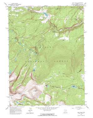
Leidy Peak Topo Map Utah
To zoom in, hover over the map of Leidy Peak
USGS Topo Quad 40109g7 - 1:24,000 scale
| Topo Map Name: | Leidy Peak |
| USGS Topo Quad ID: | 40109g7 |
| Print Size: | ca. 21 1/4" wide x 27" high |
| Southeast Coordinates: | 40.75° N latitude / 109.75° W longitude |
| Map Center Coordinates: | 40.8125° N latitude / 109.8125° W longitude |
| U.S. State: | UT |
| Filename: | o40109g7.jpg |
| Download Map JPG Image: | Leidy Peak topo map 1:24,000 scale |
| Map Type: | Topographic |
| Topo Series: | 7.5´ |
| Map Scale: | 1:24,000 |
| Source of Map Images: | United States Geological Survey (USGS) |
| Alternate Map Versions: |
Leidy Peak UT 1963, updated 1964 Download PDF Buy paper map Leidy Peak UT 1963, updated 1964 Download PDF Buy paper map Leidy Peak UT 1996, updated 2000 Download PDF Buy paper map Leidy Peak UT 2011 Download PDF Buy paper map Leidy Peak UT 2014 Download PDF Buy paper map |
| FStopo: | US Forest Service topo Leidy Peak is available: Download FStopo PDF Download FStopo TIF |
1:24,000 Topo Quads surrounding Leidy Peak
> Back to 40109e1 at 1:100,000 scale
> Back to 40108a1 at 1:250,000 scale
> Back to U.S. Topo Maps home
Leidy Peak topo map: Gazetteer
Leidy Peak: Basins
Lakeshore Basin elevation 3277m 10751′Leidy Peak: Dams
Browne Lake Dam elevation 2519m 8264′Long Park Dam elevation 3038m 9967′
Leidy Peak: Flats
Summit Park elevation 2987m 9799′Leidy Peak: Lakes
Hacking Lake elevation 3240m 10629′Pollen Lake elevation 3126m 10255′
Red Lake elevation 3004m 9855′
Stove Lake elevation 2835m 9301′
Tepee Lakes elevation 2875m 9432′
Leidy Peak: Parks
Old Carter Trail Historical marker elevation 2725m 8940′Leidy Peak: Reservoirs
Browne Lake elevation 2549m 8362′Browne Lake elevation 2519m 8264′
Long Park Reservoir elevation 3040m 9973′
Leidy Peak: Springs
Lost Spring elevation 2480m 8136′Youngs Spring elevation 2562m 8405′
Leidy Peak: Streams
Beaver Creek elevation 2529m 8297′East Fork Carter Creek elevation 2470m 8103′
Middle Fork Carter Creek elevation 2491m 8172′
West Fork Carter Creek elevation 2516m 8254′
Weyman Creek elevation 2531m 8303′
Leidy Peak: Summits
Leidy Peak elevation 3667m 12030′Ute Mountain elevation 2690m 8825′
Leidy Peak: Trails
Icy Hill Dugway elevation 2523m 8277′Leidy Peak digital topo map on disk
Buy this Leidy Peak topo map showing relief, roads, GPS coordinates and other geographical features, as a high-resolution digital map file on DVD:


