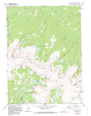
Whiterocks Lake Topo Map Utah
To zoom in, hover over the map of Whiterocks Lake
USGS Topo Quad 40109g8 - 1:24,000 scale
| Topo Map Name: | Whiterocks Lake |
| USGS Topo Quad ID: | 40109g8 |
| Print Size: | ca. 21 1/4" wide x 27" high |
| Southeast Coordinates: | 40.75° N latitude / 109.875° W longitude |
| Map Center Coordinates: | 40.8125° N latitude / 109.9375° W longitude |
| U.S. State: | UT |
| Filename: | o40109g8.jpg |
| Download Map JPG Image: | Whiterocks Lake topo map 1:24,000 scale |
| Map Type: | Topographic |
| Topo Series: | 7.5´ |
| Map Scale: | 1:24,000 |
| Source of Map Images: | United States Geological Survey (USGS) |
| Alternate Map Versions: |
Whiterocks Lake UT 1963, updated 1964 Download PDF Buy paper map Whiterocks Lake UT 1963, updated 1970 Download PDF Buy paper map Whiterocks Lake UT 1963, updated 1983 Download PDF Buy paper map Whiterocks Lake UT 1990, updated 1995 Download PDF Buy paper map Whiterocks Lake UT 1996, updated 1999 Download PDF Buy paper map Whiterocks Lake UT 2011 Download PDF Buy paper map Whiterocks Lake UT 2014 Download PDF Buy paper map |
| FStopo: | US Forest Service topo Whiterocks Lake is available: Download FStopo PDF Download FStopo TIF |
1:24,000 Topo Quads surrounding Whiterocks Lake
> Back to 40109e1 at 1:100,000 scale
> Back to 40108a1 at 1:250,000 scale
> Back to U.S. Topo Maps home
Whiterocks Lake topo map: Gazetteer
Whiterocks Lake: Areas
Lightning Park elevation 3318m 10885′Whiterocks Lake: Dams
Daggett Lake Dam elevation 3190m 10465′Spirit Lake Dam elevation 3104m 10183′
Whiterocks Lake Dam elevation 3224m 10577′
Whiterocks Lake: Flats
Bear Park elevation 2839m 9314′Lightning Park elevation 3288m 10787′
Weyman Park elevation 3205m 10515′
Whiterocks Lake: Gaps
Gabbro Pass elevation 3563m 11689′Whiterocks Lake: Lakes
Anson Lake elevation 3225m 10580′Blue Lake elevation 3433m 11263′
Daggett Lake elevation 3190m 10465′
Deadman Lake elevation 3348m 10984′
Dollar Lake elevation 3202m 10505′
Lake Wilde elevation 3421m 11223′
Lamb Lakes elevation 3165m 10383′
Pearl Lake elevation 3263m 10705′
Potter Lake elevation 3089m 10134′
Sand Lake elevation 3177m 10423′
Saucer Lake elevation 3202m 10505′
Spirit Lake elevation 3100m 10170′
Teds Lake elevation 3152m 10341′
Weyman Lakes elevation 3164m 10380′
Wooley Lakes elevation 3237m 10620′
Workman Lake elevation 3189m 10462′
Whiterocks Lake: Reservoirs
Spirit Lake elevation 3104m 10183′Whiterocks Lake elevation 3224m 10577′
Whiterocks Lake: Summits
Mount Untermann elevation 3675m 12057′Whiterocks Lake digital topo map on disk
Buy this Whiterocks Lake topo map showing relief, roads, GPS coordinates and other geographical features, as a high-resolution digital map file on DVD:


