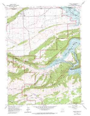
Manila Topo Map Utah
To zoom in, hover over the map of Manila
USGS Topo Quad 40109h6 - 1:24,000 scale
| Topo Map Name: | Manila |
| USGS Topo Quad ID: | 40109h6 |
| Print Size: | ca. 21 1/4" wide x 27" high |
| Southeast Coordinates: | 40.875° N latitude / 109.625° W longitude |
| Map Center Coordinates: | 40.9375° N latitude / 109.6875° W longitude |
| U.S. States: | UT, WY |
| Filename: | o40109h6.jpg |
| Download Map JPG Image: | Manila topo map 1:24,000 scale |
| Map Type: | Topographic |
| Topo Series: | 7.5´ |
| Map Scale: | 1:24,000 |
| Source of Map Images: | United States Geological Survey (USGS) |
| Alternate Map Versions: |
Manila UT 1963, updated 1964 Download PDF Buy paper map Manila UT 1963, updated 1971 Download PDF Buy paper map Manila UT 1996, updated 1999 Download PDF Buy paper map Manila UT 2011 Download PDF Buy paper map Manila UT 2014 Download PDF Buy paper map |
| FStopo: | US Forest Service topo Manila is available: Download FStopo PDF Download FStopo TIF |
1:24,000 Topo Quads surrounding Manila
> Back to 40109e1 at 1:100,000 scale
> Back to 40108a1 at 1:250,000 scale
> Back to U.S. Topo Maps home
Manila topo map: Gazetteer
Manila: Airports
Manila Airport elevation 1873m 6145′Manila: Bays
Sheep Creek Bay elevation 1842m 6043′Manila: Canals
Peoples Canal elevation 1893m 6210′Peoples Canal elevation 1882m 6174′
Sheep Creek Canal elevation 1958m 6423′
Manila: Capes
Beehive Point elevation 1865m 6118′Manila: Gaps
Sheep Creek Gap elevation 1901m 6236′Manila: Islands
Kingfisher Island elevation 1930m 6332′Manila: Lakes
Dowds Hole elevation 2340m 7677′Manila: Parks
Navajo Cliffs Picnic Area elevation 1904m 6246′Manila: Populated Places
Manila elevation 1935m 6348′Manila: Ridges
The Reaves elevation 1948m 6391′Manila: Springs
Dowd Spring elevation 2284m 7493′Summit Springs elevation 2512m 8241′
Manila: Streams
Death Valley Creek elevation 1866m 6122′Henrys Fork elevation 1842m 6043′
Henrys Fork elevation 1842m 6043′
Kingfisher Creek elevation 1842m 6043′
Sheep Creek elevation 1849m 6066′
Spring Creek elevation 2138m 7014′
Manila: Summits
Dowd Mountain elevation 2465m 8087′Manila: Valleys
Birch Spring Draw elevation 1852m 6076′Hideout Draw elevation 1851m 6072′
Kingfisher Canyon elevation 1842m 6043′
South Valley elevation 1854m 6082′
Manila digital topo map on disk
Buy this Manila topo map showing relief, roads, GPS coordinates and other geographical features, as a high-resolution digital map file on DVD:


