Duchesne Sw Topo Map Utah
To zoom in, hover over the map of Duchesne Sw
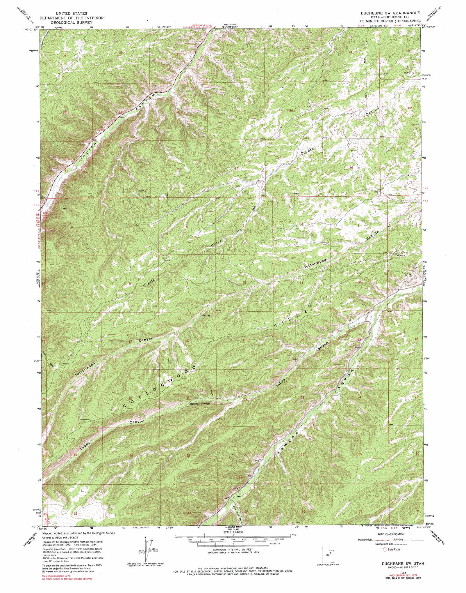
USGS Topo Quad 40110a4 - 1:24,000 scale
| Topo Map Name: | Duchesne Sw |
| USGS Topo Quad ID: | 40110a4 |
| Print Size: | ca. 21 1/4" wide x 27" high |
| Southeast Coordinates: | 40° N latitude / 110.375° W longitude |
| Map Center Coordinates: | 40.0625° N latitude / 110.4375° W longitude |
| U.S. State: | UT |
| Filename: | o40110a4.jpg |
| Download Map JPG Image: | Duchesne Sw topo map 1:24,000 scale |
| Map Type: | Topographic |
| Topo Series: | 7.5´ |
| Map Scale: | 1:24,000 |
| Source of Map Images: | United States Geological Survey (USGS) |
| Alternate Map Versions: |
Duchesne SW UT 1964, updated 1966 Download PDF Buy paper map Duchesne SW UT 1964, updated 1980 Download PDF Buy paper map Duchesne SW UT 2011 Download PDF Buy paper map Duchesne SW UT 2014 Download PDF Buy paper map |
1:24,000 Topo Quads surrounding Duchesne Sw
Tabiona |
Blacktail Mountain |
Talmage |
Altamont |
Bluebell |
Strawberry Pinnacles |
Rabbit Gulch |
Duchesne |
Duchesne Ne |
Bridgeland |
Sams Canyon |
Buck Knoll |
Duchesne Sw |
Duchesne Se |
Myton Sw |
Jones Hollow |
Lance Canyon |
Anthro Mountain |
Anthro Mountain Ne |
Gilsonite Draw |
Minnie Maud Creek West |
Minnie Maud Creek East |
Wood Canyon |
Currant Canyon |
Cowboy Bench |
> Back to 40110a1 at 1:100,000 scale
> Back to 40110a1 at 1:250,000 scale
> Back to U.S. Topo Maps home
Duchesne Sw topo map: Gazetteer
Duchesne Sw: Parks
Sowers Canyon Wildlife Management Area elevation 1982m 6502′Duchesne Sw: Ridges
Cottonwood Ridge elevation 2008m 6587′Duchesne Sw: Springs
Marshall Springs elevation 2106m 6909′Duchesne Sw: Valleys
Tabby Canyon elevation 1910m 6266′Wire Fence Canyon elevation 2024m 6640′
Duchesne Sw digital topo map on disk
Buy this Duchesne Sw topo map showing relief, roads, GPS coordinates and other geographical features, as a high-resolution digital map file on DVD: