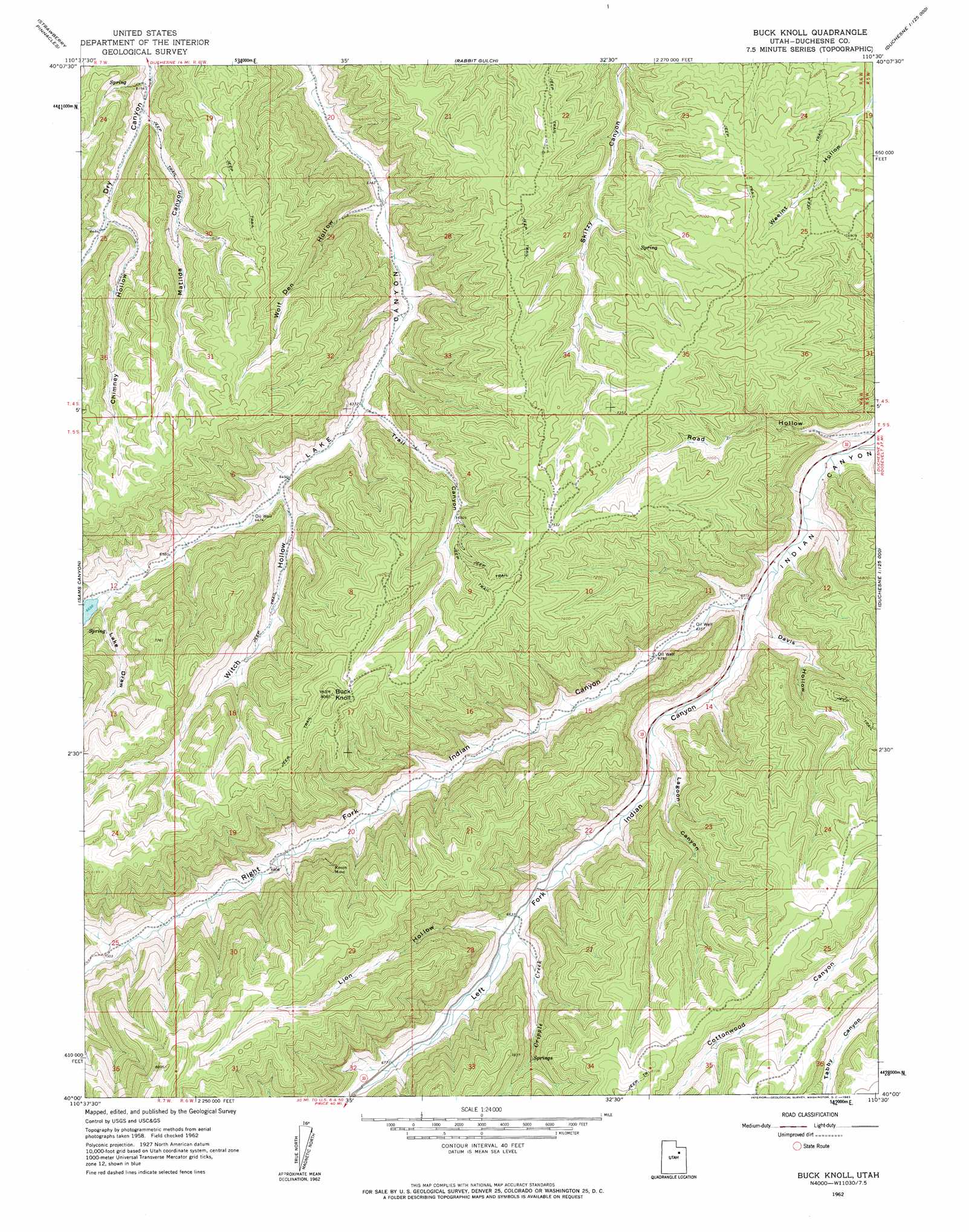
Buck Knoll Topo Map Utah
To zoom in, hover over the map of Buck Knoll
USGS Topo Quad 40110a5 - 1:24,000 scale
| Topo Map Name: | Buck Knoll |
| USGS Topo Quad ID: | 40110a5 |
| Print Size: | ca. 21 1/4" wide x 27" high |
| Southeast Coordinates: | 40° N latitude / 110.5° W longitude |
| Map Center Coordinates: | 40.0625° N latitude / 110.5625° W longitude |
| U.S. State: | UT |
| Filename: | o40110a5.jpg |
| Download Map JPG Image: | Buck Knoll topo map 1:24,000 scale |
| Map Type: | Topographic |
| Topo Series: | 7.5´ |
| Map Scale: | 1:24,000 |
| Source of Map Images: | United States Geological Survey (USGS) |
| Alternate Map Versions: |
Buck Knoll UT 1962, updated 1963 Download PDF Buy paper map Buck Knoll UT 2011 Download PDF Buy paper map Buck Knoll UT 2014 Download PDF Buy paper map |
1:24,000 Topo Quads surrounding Buck Knoll
Tabby Mountain |
Tabiona |
Blacktail Mountain |
Talmage |
Altamont |
Fruitland |
Strawberry Pinnacles |
Rabbit Gulch |
Duchesne |
Duchesne Ne |
Avintaquin Canyon |
Sams Canyon |
Buck Knoll |
Duchesne Sw |
Duchesne Se |
Gray Head Peak |
Jones Hollow |
Lance Canyon |
Anthro Mountain |
Anthro Mountain Ne |
Matts Summit |
Minnie Maud Creek West |
Minnie Maud Creek East |
Wood Canyon |
Currant Canyon |
> Back to 40110a1 at 1:100,000 scale
> Back to 40110a1 at 1:250,000 scale
> Back to U.S. Topo Maps home
Buck Knoll topo map: Gazetteer
Buck Knoll: Mines
Raven Mine elevation 2197m 7208′Buck Knoll: Parks
Skitzy Wildlife Management Area elevation 2239m 7345′Buck Knoll: Streams
Cripple Creek elevation 2025m 6643′Buck Knoll: Summits
Buck Knoll elevation 2453m 8047′Buck Knoll: Valleys
Chimney Hollow elevation 1971m 6466′Davis Hollow elevation 1943m 6374′
Lagoon Canyon elevation 1974m 6476′
Lake Draw elevation 2049m 6722′
Left Fork Indian Canyon elevation 1931m 6335′
Lion Hollow elevation 2047m 6715′
Matilda Canyon elevation 1918m 6292′
Right Fork Indian Canyon elevation 1927m 6322′
Road Hollow elevation 1931m 6335′
Trail Canyon elevation 1957m 6420′
Witch Hollow elevation 1974m 6476′
Wolf Den Hollow elevation 1907m 6256′
Buck Knoll digital topo map on disk
Buy this Buck Knoll topo map showing relief, roads, GPS coordinates and other geographical features, as a high-resolution digital map file on DVD: