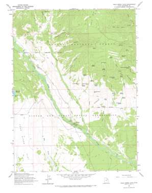
Pole Creek Cave Topo Map Utah
To zoom in, hover over the map of Pole Creek Cave
USGS Topo Quad 40110e1 - 1:24,000 scale
| Topo Map Name: | Pole Creek Cave |
| USGS Topo Quad ID: | 40110e1 |
| Print Size: | ca. 21 1/4" wide x 27" high |
| Southeast Coordinates: | 40.5° N latitude / 110° W longitude |
| Map Center Coordinates: | 40.5625° N latitude / 110.0625° W longitude |
| U.S. State: | UT |
| Filename: | o40110e1.jpg |
| Download Map JPG Image: | Pole Creek Cave topo map 1:24,000 scale |
| Map Type: | Topographic |
| Topo Series: | 7.5´ |
| Map Scale: | 1:24,000 |
| Source of Map Images: | United States Geological Survey (USGS) |
| Alternate Map Versions: |
Pole Creek Cave UT 1965, updated 1967 Download PDF Buy paper map Dark Canyon UT 1996, updated 2000 Download PDF Buy paper map Dark Canyon UT 2011 Download PDF Buy paper map Dark Canyon UT 2014 Download PDF Buy paper map |
| FStopo: | US Forest Service topo Dark Canyon is available: Download FStopo PDF Download FStopo TIF |
1:24,000 Topo Quads surrounding Pole Creek Cave
> Back to 40110e1 at 1:100,000 scale
> Back to 40110a1 at 1:250,000 scale
> Back to U.S. Topo Maps home
Pole Creek Cave topo map: Gazetteer
Pole Creek Cave: Bridges
Lower Vinta Canal Bridge elevation 2246m 7368′Uinta River Bridge elevation 2236m 7335′
Upper Vinta Canal Bridge elevation 2256m 7401′
Pole Creek Cave: Canals
Pole Creek Canal elevation 2253m 7391′Powerplant Canal elevation 2255m 7398′
Pole Creek Cave: Forests
Ashley National Forest elevation 3035m 9957′Pole Creek Cave: Reservoirs
Ant Reservoirs elevation 2268m 7440′Nephi Pond elevation 2346m 7696′
Pole Creek Cave: Springs
Beaver Spring elevation 2368m 7769′Blank Spring elevation 2872m 9422′
Boundary Spring elevation 2286m 7500′
Buffalo Spring elevation 2496m 8188′
Center Fork Spring elevation 2619m 8592′
Coyote Spring elevation 2455m 8054′
Elk Spring elevation 2879m 9445′
Fawn Spring elevation 2559m 8395′
Grits Spring elevation 2829m 9281′
Hackamore Spring elevation 2319m 7608′
Henry Spring elevation 2579m 8461′
Lightning Killed Bull Spring elevation 2626m 8615′
Mugwump Spring elevation 2863m 9393′
Preece Spring elevation 2457m 8061′
Puppy Spring elevation 2626m 8615′
Ray Spring elevation 2739m 8986′
Rock Spring elevation 2859m 9379′
Russell Spring Number 1 elevation 2488m 8162′
Russell Spring Number 2 elevation 2486m 8156′
Russell Spring Number 3 elevation 2412m 7913′
Saddle Spring elevation 2405m 7890′
Trail Spring elevation 2560m 8398′
Pole Creek Cave: Streams
Bull Elk Creek elevation 2536m 8320′Pole Creek elevation 2086m 6843′
West Fork Farm Creek elevation 2506m 8221′
Pole Creek Cave: Valleys
Dark Canyon elevation 2433m 7982′East Cart Hollow elevation 2290m 7513′
First Canyon elevation 2329m 7641′
Harmston Canyon elevation 2436m 7992′
Nephi Draw elevation 2072m 6797′
Pole Creek Cave digital topo map on disk
Buy this Pole Creek Cave topo map showing relief, roads, GPS coordinates and other geographical features, as a high-resolution digital map file on DVD:


