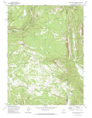
Iron Mine Mountain Topo Map Utah
To zoom in, hover over the map of Iron Mine Mountain
USGS Topo Quad 40110e8 - 1:24,000 scale
| Topo Map Name: | Iron Mine Mountain |
| USGS Topo Quad ID: | 40110e8 |
| Print Size: | ca. 21 1/4" wide x 27" high |
| Southeast Coordinates: | 40.5° N latitude / 110.875° W longitude |
| Map Center Coordinates: | 40.5625° N latitude / 110.9375° W longitude |
| U.S. State: | UT |
| Filename: | o40110e8.jpg |
| Download Map JPG Image: | Iron Mine Mountain topo map 1:24,000 scale |
| Map Type: | Topographic |
| Topo Series: | 7.5´ |
| Map Scale: | 1:24,000 |
| Source of Map Images: | United States Geological Survey (USGS) |
| Alternate Map Versions: |
Iron Mine Mountain UT 1972, updated 1974 Download PDF Buy paper map Iron Mine Mountain UT 1996, updated 2000 Download PDF Buy paper map Iron Mine Mountain UT 2011 Download PDF Buy paper map Iron Mine Mountain UT 2014 Download PDF Buy paper map |
| FStopo: | US Forest Service topo Iron Mine Mountain is available: Download FStopo PDF Download FStopo TIF |
1:24,000 Topo Quads surrounding Iron Mine Mountain
> Back to 40110e1 at 1:100,000 scale
> Back to 40110a1 at 1:250,000 scale
> Back to U.S. Topo Maps home
Iron Mine Mountain topo map: Gazetteer
Iron Mine Mountain: Falls
Smooth Rock Falls elevation 2575m 8448′Iron Mine Mountain: Flats
Lambert Meadow elevation 2903m 9524′Mill Flat elevation 2309m 7575′
Iron Mine Mountain: Lakes
Alexander Lake elevation 2848m 9343′Broadhead Lake elevation 3032m 9947′
Iron Mine Lake elevation 2924m 9593′
Iron Mine Mountain: Pillars
Duchesne Monument elevation 2486m 8156′Iron Mine Mountain: Reservoirs
Little Pond elevation 2971m 9747′Spruce Springs Reservoir elevation 2880m 9448′
Iron Mine Mountain: Springs
Cold Spring elevation 2902m 9520′Iron Mine Mountain: Streams
Beaver Creek elevation 2332m 7650′Cobble Creek elevation 2553m 8375′
Iron Mine Creek elevation 2280m 7480′
Little Deer Creek elevation 2475m 8120′
Shale Creek elevation 2329m 7641′
Iron Mine Mountain: Summits
Iron Mine Mountain elevation 3187m 10456′Iron Mine Mountain: Tunnels
Duchesne Tunnel elevation 3074m 10085′East Portal Duchesne Tunnel elevation 2562m 8405′
Hades Rhoades Tunnel elevation 2751m 9025′
Iron Mine Mountain: Valleys
Cataract Gorge elevation 2443m 8015′Trail Hollow elevation 2255m 7398′
Iron Mine Mountain digital topo map on disk
Buy this Iron Mine Mountain topo map showing relief, roads, GPS coordinates and other geographical features, as a high-resolution digital map file on DVD:


