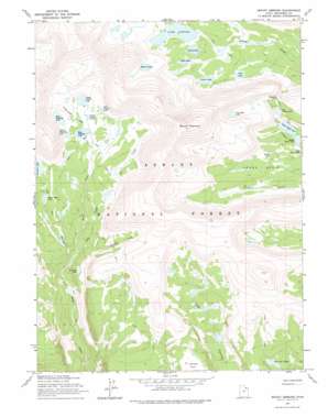
Mount Emmons Topo Map Utah
To zoom in, hover over the map of Mount Emmons
USGS Topo Quad 40110f3 - 1:24,000 scale
| Topo Map Name: | Mount Emmons |
| USGS Topo Quad ID: | 40110f3 |
| Print Size: | ca. 21 1/4" wide x 27" high |
| Southeast Coordinates: | 40.625° N latitude / 110.25° W longitude |
| Map Center Coordinates: | 40.6875° N latitude / 110.3125° W longitude |
| U.S. State: | UT |
| Filename: | o40110f3.jpg |
| Download Map JPG Image: | Mount Emmons topo map 1:24,000 scale |
| Map Type: | Topographic |
| Topo Series: | 7.5´ |
| Map Scale: | 1:24,000 |
| Source of Map Images: | United States Geological Survey (USGS) |
| Alternate Map Versions: |
Mount Emmons UT 1965, updated 1967 Download PDF Buy paper map Mount Emmons UT 1965, updated 1975 Download PDF Buy paper map Mount Emmons UT 1965, updated 1975 Download PDF Buy paper map Mount Emmons UT 1996, updated 2000 Download PDF Buy paper map Mount Emmons UT 2011 Download PDF Buy paper map Mount Emmons UT 2014 Download PDF Buy paper map |
| FStopo: | US Forest Service topo Mount Emmons is available: Download FStopo PDF Download FStopo TIF |
1:24,000 Topo Quads surrounding Mount Emmons
> Back to 40110e1 at 1:100,000 scale
> Back to 40110a1 at 1:250,000 scale
> Back to U.S. Topo Maps home
Mount Emmons topo map: Gazetteer
Mount Emmons: Basins
Krebs Basin elevation 3305m 10843′Mount Emmons: Dams
Deer Lake Dam elevation 3128m 10262′East Timothy Dam elevation 3370m 11056′
Lake Atwood Dam elevation 3363m 11033′
Upper Chain Lake Dam elevation 3240m 10629′
Mount Emmons: Flats
Jackson Park elevation 3262m 10702′Mount Emmons: Gaps
Roberts Pass elevation 3399m 11151′Mount Emmons: Lakes
Allen Lake elevation 3348m 10984′Allred Lake elevation 3347m 10980′
B-29 Lake elevation 3275m 10744′
Carrol Lake elevation 3299m 10823′
Center Timothy Lake elevation 3361m 11026′
Chain Lakes elevation 3250m 10662′
East Carroll Lake elevation 3420m 11220′
East Timothy Lake elevation 3360m 11023′
Fourth Chain Lake elevation 3310m 10859′
Grayling Lake elevation 3042m 9980′
Krebs Lake elevation 3288m 10787′
Lily Pad Lakes elevation 3131m 10272′
Lower Carroll Lake elevation 3373m 11066′
Middle Chain Lake elevation 3238m 10623′
Oke Doke Lake elevation 3446m 11305′
Roberts Lake elevation 3519m 11545′
Timothy Lakes elevation 3402m 11161′
Upper Carroll Lake elevation 3397m 11145′
West Timothy Lake elevation 3385m 11105′
White Miller Lake elevation 3251m 10666′
Mount Emmons: Reservoirs
Deer Lake elevation 3128m 10262′East Timothy Lake elevation 3370m 11056′
Lake Atwood elevation 3364m 11036′
Upper Chain Lake elevation 3240m 10629′
Mount Emmons: Streams
Buffalo Creek elevation 3052m 10013′Owl Creek elevation 3022m 9914′
Mount Emmons: Summits
Mount Emmons elevation 4090m 13418′Mount Emmons digital topo map on disk
Buy this Mount Emmons topo map showing relief, roads, GPS coordinates and other geographical features, as a high-resolution digital map file on DVD:


