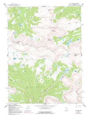
Fox Lake Topo Map Utah
To zoom in, hover over the map of Fox Lake
USGS Topo Quad 40110g2 - 1:24,000 scale
| Topo Map Name: | Fox Lake |
| USGS Topo Quad ID: | 40110g2 |
| Print Size: | ca. 21 1/4" wide x 27" high |
| Southeast Coordinates: | 40.75° N latitude / 110.125° W longitude |
| Map Center Coordinates: | 40.8125° N latitude / 110.1875° W longitude |
| U.S. State: | UT |
| Filename: | o40110g2.jpg |
| Download Map JPG Image: | Fox Lake topo map 1:24,000 scale |
| Map Type: | Topographic |
| Topo Series: | 7.5´ |
| Map Scale: | 1:24,000 |
| Source of Map Images: | United States Geological Survey (USGS) |
| Alternate Map Versions: |
Fox Lake UT 1965, updated 1968 Download PDF Buy paper map Fox Lake UT 1965, updated 1991 Download PDF Buy paper map Fox Lake UT 1996, updated 1999 Download PDF Buy paper map Fox Lake UT 2011 Download PDF Buy paper map Fox Lake UT 2014 Download PDF Buy paper map |
| FStopo: | US Forest Service topo Fox Lake is available: Download FStopo PDF Download FStopo TIF |
1:24,000 Topo Quads surrounding Fox Lake
> Back to 40110e1 at 1:100,000 scale
> Back to 40110a1 at 1:250,000 scale
> Back to U.S. Topo Maps home
Fox Lake topo map: Gazetteer
Fox Lake: Bridges
Shale Creek Bridge elevation 2949m 9675′Fox Lake: Dams
Crescent Lake Dam elevation 3307m 10849′Fox Lake Dam elevation 3296m 10813′
Island Lake Dam elevation 3291m 10797′
Fox Lake: Flats
Corral Meadows elevation 3163m 10377′Long Meadow elevation 3131m 10272′
Fox Lake: Gaps
Fox Queant Pass elevation 3471m 11387′Thompson Pass elevation 3419m 11217′
Fox Lake: Lakes
Beaver Lake elevation 3204m 10511′Bennion Lake elevation 3339m 10954′
Bowden Lake elevation 3261m 10698′
Brook Lake elevation 3335m 10941′
Coffin Lake elevation 3310m 10859′
Craig Lake elevation 3308m 10853′
Crescent Lake elevation 3302m 10833′
Davis Lakes elevation 3359m 11020′
Dime Lake elevation 3264m 10708′
Dine Lake elevation 3192m 10472′
Divide Lake elevation 3421m 11223′
Fox Lake elevation 3287m 10784′
Kabell Lake elevation 3156m 10354′
Kidney Lakes elevation 3311m 10862′
Rainbow Lake elevation 3394m 11135′
Round Lake elevation 3239m 10626′
Samuels Lake elevation 3348m 10984′
Verlie Lake elevation 3326m 10912′
Weeping Ledge Lake elevation 3423m 11230′
Wilderness Lake elevation 3416m 11207′
Fox Lake: Parks
North Fork Park elevation 3070m 10072′Fox Lake: Reservoirs
Crescent Lake elevation 3307m 10849′Fox Lake elevation 3296m 10813′
Island Lake elevation 3291m 10797′
Fox Lake: Ridges
Kabell Ridge elevation 3357m 11013′Fox Lake: Streams
Gilbert Creek elevation 3073m 10082′Shale Creek elevation 2859m 9379′
Fox Lake: Summits
North Burro Peak elevation 3860m 12664′South Burro Peak elevation 3873m 12706′
Thompson Peak elevation 3589m 11774′
Fox Lake: Trails
Shale Dugway elevation 2965m 9727′Fox Lake digital topo map on disk
Buy this Fox Lake topo map showing relief, roads, GPS coordinates and other geographical features, as a high-resolution digital map file on DVD:


