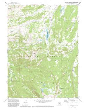
Whitney Reservoir Topo Map Utah
To zoom in, hover over the map of Whitney Reservoir
USGS Topo Quad 40110g8 - 1:24,000 scale
| Topo Map Name: | Whitney Reservoir |
| USGS Topo Quad ID: | 40110g8 |
| Print Size: | ca. 21 1/4" wide x 27" high |
| Southeast Coordinates: | 40.75° N latitude / 110.875° W longitude |
| Map Center Coordinates: | 40.8125° N latitude / 110.9375° W longitude |
| U.S. State: | UT |
| Filename: | o40110g8.jpg |
| Download Map JPG Image: | Whitney Reservoir topo map 1:24,000 scale |
| Map Type: | Topographic |
| Topo Series: | 7.5´ |
| Map Scale: | 1:24,000 |
| Source of Map Images: | United States Geological Survey (USGS) |
| Alternate Map Versions: |
Whitney Reservoir UT 1972, updated 1974 Download PDF Buy paper map Whitney Reservoir UT 1972, updated 1980 Download PDF Buy paper map Whitney Reservoir UT 1972, updated 1980 Download PDF Buy paper map Whitney Reservoir UT 1998, updated 2001 Download PDF Buy paper map Whitney Reservoir UT 2011 Download PDF Buy paper map Whitney Reservoir UT 2014 Download PDF Buy paper map |
| FStopo: | US Forest Service topo Whitney Reservoir is available: Download FStopo PDF Download FStopo TIF |
1:24,000 Topo Quads surrounding Whitney Reservoir
> Back to 40110e1 at 1:100,000 scale
> Back to 40110a1 at 1:250,000 scale
> Back to U.S. Topo Maps home
Whitney Reservoir topo map: Gazetteer
Whitney Reservoir: Dams
Fish Lake Dam elevation 3149m 10331′Sand Lake Dam elevation 3094m 10150′
Whitney Reservoir Dam elevation 2817m 9242′
Whitney Reservoir: Gaps
Gold Hill Pass elevation 3027m 9931′Moffit Pass elevation 3037m 9963′
Whitney Reservoir: Lakes
Beaver Lake elevation 2874m 9429′Whiskey Island Lake elevation 3156m 10354′
Whitney Reservoir: Reservoirs
Bourbon Lake elevation 2995m 9826′Fish Lake elevation 3149m 10331′
Fish Lake elevation 3104m 10183′
Round Lake elevation 3033m 9950′
Sand Lake elevation 3092m 10144′
Whitney Reservoir elevation 2817m 9242′
Whitney Reservoir: Streams
Dry Fork elevation 2405m 7890′East Fork Moffit Creek elevation 2594m 8510′
Gardners Fork elevation 2424m 7952′
Meadow Creek elevation 2708m 8884′
Middle Fork Weber River elevation 2413m 7916′
Whiskey Creek elevation 2776m 9107′
Whitney Reservoir: Summits
Gold Hill elevation 3221m 10567′Holiday Park Peak elevation 2834m 9297′
Moffit Peak elevation 3357m 11013′
Whitney Reservoir: Valleys
Carrot Hollow elevation 2790m 9153′Road Hollow elevation 2803m 9196′
Whitney Reservoir digital topo map on disk
Buy this Whitney Reservoir topo map showing relief, roads, GPS coordinates and other geographical features, as a high-resolution digital map file on DVD:


