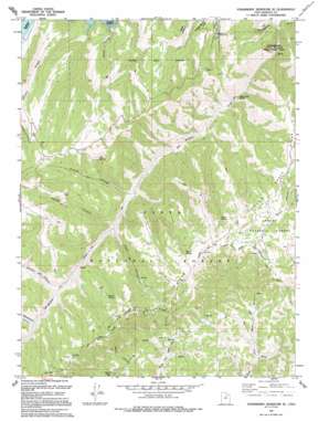
Strawberry Reservoir Se Topo Map Utah
To zoom in, hover over the map of Strawberry Reservoir Se
USGS Topo Quad 40111a1 - 1:24,000 scale
| Topo Map Name: | Strawberry Reservoir Se |
| USGS Topo Quad ID: | 40111a1 |
| Print Size: | ca. 21 1/4" wide x 27" high |
| Southeast Coordinates: | 40° N latitude / 111° W longitude |
| Map Center Coordinates: | 40.0625° N latitude / 111.0625° W longitude |
| U.S. State: | UT |
| Filename: | o40111a1.jpg |
| Download Map JPG Image: | Strawberry Reservoir Se topo map 1:24,000 scale |
| Map Type: | Topographic |
| Topo Series: | 7.5´ |
| Map Scale: | 1:24,000 |
| Source of Map Images: | United States Geological Survey (USGS) |
| Alternate Map Versions: |
Strawberry Reservoir SE UT 1967, updated 1969 Download PDF Buy paper map Strawberry Reservoir SE UT 1967, updated 1979 Download PDF Buy paper map Strawberry Reservoir SE UT 1993, updated 1994 Download PDF Buy paper map Strawberry Reservoir SE UT 1996, updated 2000 Download PDF Buy paper map Strawberry Reservoir SE UT 2011 Download PDF Buy paper map Strawberry Reservoir SE UT 2014 Download PDF Buy paper map |
| FStopo: | US Forest Service topo Strawberry Reservoir SE is available: Download FStopo PDF Download FStopo TIF |
1:24,000 Topo Quads surrounding Strawberry Reservoir Se
> Back to 40111a1 at 1:100,000 scale
> Back to 40110a1 at 1:250,000 scale
> Back to U.S. Topo Maps home
Strawberry Reservoir Se topo map: Gazetteer
Strawberry Reservoir Se: Ridges
Poison Ridge elevation 2655m 8710′Willow Creek Ridge elevation 2691m 8828′
Strawberry Reservoir Se: Streams
Indian Creek elevation 2369m 7772′Willow Creek elevation 2213m 7260′
Strawberry Reservoir Se: Valleys
Broad Hollow elevation 2311m 7582′Buffalo Canyon elevation 2498m 8195′
Center Canyon elevation 2473m 8113′
French Hollow elevation 2448m 8031′
Racetrack Hollow elevation 2529m 8297′
Road Hollow elevation 2479m 8133′
Strawberry Reservoir Se digital topo map on disk
Buy this Strawberry Reservoir Se topo map showing relief, roads, GPS coordinates and other geographical features, as a high-resolution digital map file on DVD:


